Excessive lake-effect snowfall to disrupt business into Wednesday

Summary
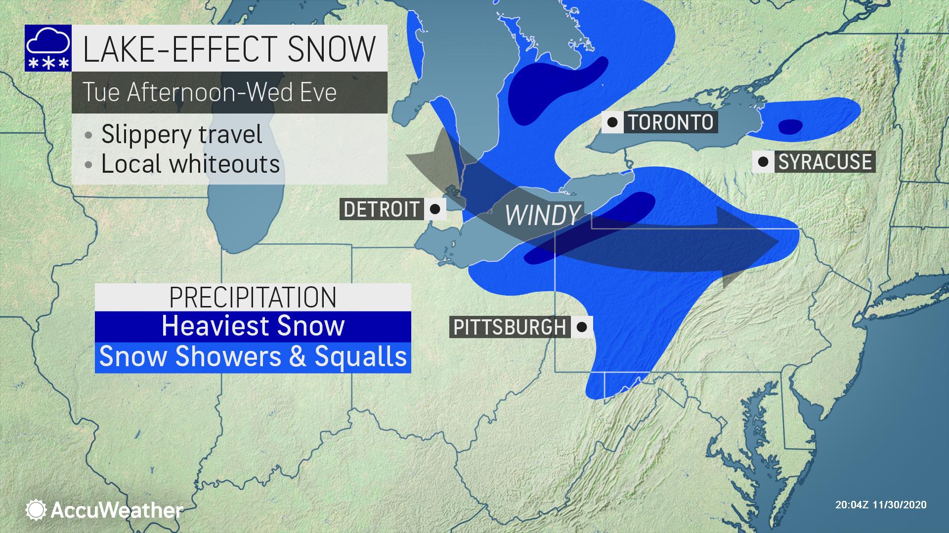
Over a foot of new snow is expected by early Wednesday, with isolated amounts in excess of two feet possible.
Key Highlights
Threats: Heavy snow, messy travel
States affected: NY, OH, PA, MD, WV
When: December 1-2
Colder air behind yesterday’s storm is forecast to lead to accumulating snow from portions of the Midwest through the northern Appalachians. Enough snow to cause slippery travel can occur throughout this swath into Tuesday night.
- Expect ground logistics disruption due to road closures, downed trees, and power outages especially along portions of Interstates 70, 76, 80 and 90
- Temporary COVID-19 response structures will be especially at risk in high winds and when snow load adds weight
- Structure stress and damage can occur due to heavy snow load
- Retail: Shovel and salt walkways, dry high traffic areas inside near your entrance, put up “Wet Floor” signs, and keep all floors clear to help prevent falls and reduce liability
The heaviest snowfall is expected downwind of the Great Lakes and just inland from their shores. Some locations from northeast Ohio to western New York may end up with over a foot of new snow by early Wednesday, with isolated amounts in excess of two feet. The lake-effect snow is likely to include blinding snow squalls along portions of Interstates 70, 76, 80 and 90 over the interior Northeastern states.
Lakeshore flooding is possible along the southeastern shores of Lake Michigan, Lake Erie and Lake Superior and the eastern shore of Lake Ontario.
The cold air is forecast to impact the South Central and Southeast states through Wednesday. The first freezes of the season are in store as far southeast as the northern interior counties of the Florida Peninsula by the middle of the week.


