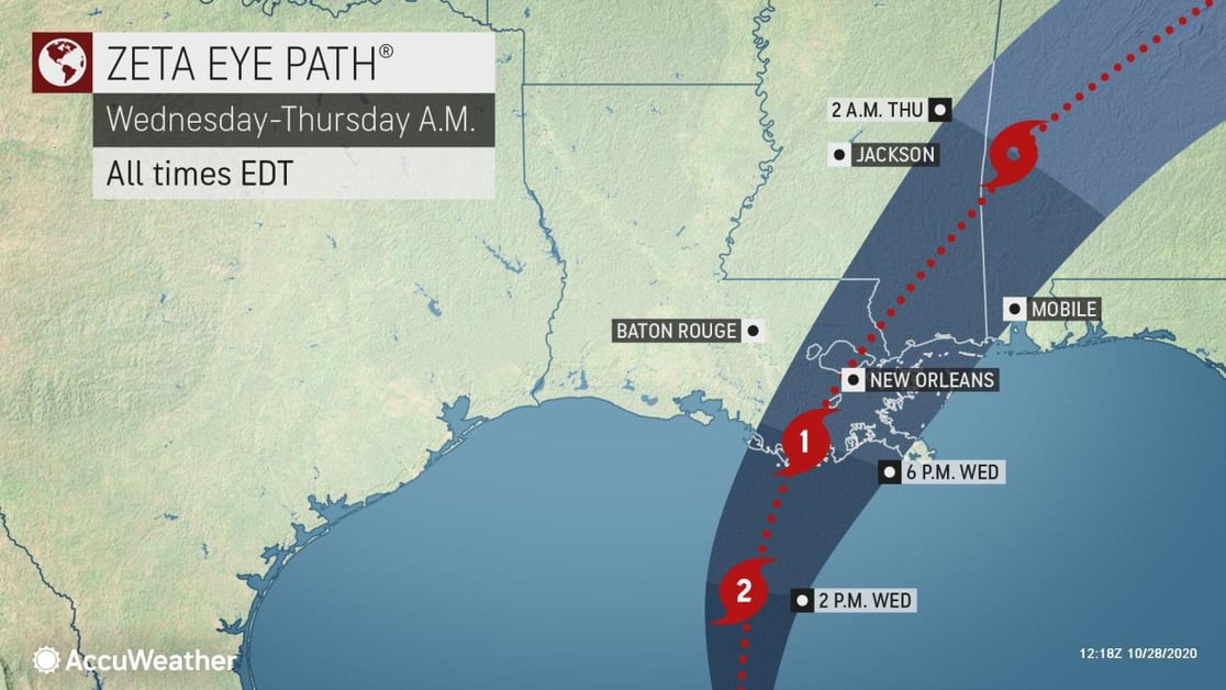
The worst impacts from Zeta; including the potential for tornadoes; are expected along and just to the east of where the storm makes landfall — southeastern Louisiana and southern Mississippi.
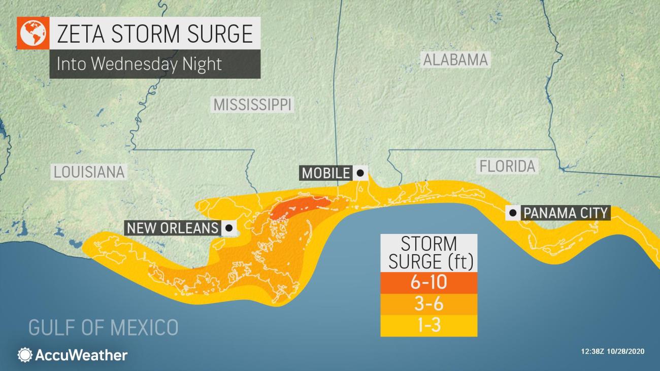
Significant coastal flooding is also anticipated due to a moderate storm surge of six to as much as nine feet over portions of southeastern Louisiana.
Tropical-storm-force wind gusts may extend well inland through the southern Appalachians into Thursday, which may result in some isolated power outages.
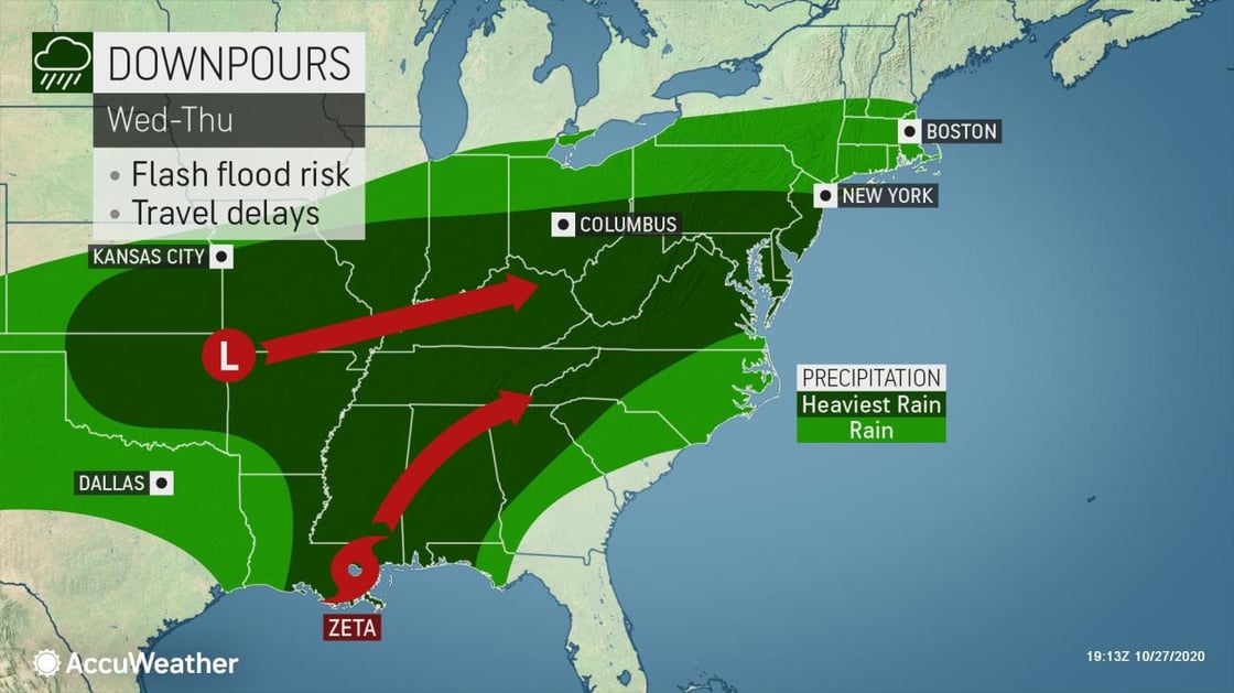
Zeta will then combine with a strong non-tropical storm system moving east out of the southern Plains to bring a large swath of heavy rainfall to the Ohio Valley and Middle Atlantic states Wednesday night through Thursday night.
Winds
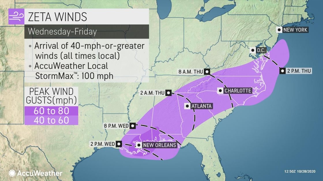
Strong winds are expected to arrive along the central Gulf Coast of the U.S. Wednesday afternoon as the storm moves northward. Gusty winds will then spread northeastward through the end of the week, arriving for parts of the mid-Atlantic as early as late Thursday night.
The current expectation is for wind gusts of 60-80 mph with an AccuWeather Local StormMax™ of 100 mph near and just to the east of where the center makes landfall late Wednesday. These winds will be strong enough to cause widespread damage to trees and power lines, as well as some weaker structures.
With some additional energy provided from a non-tropical storm system moving east out of Texas, wind gusts of 40-60 mph will extend along and south of the track Zeta all the way through the Southeast and mid-Atlantic.
Rainfall
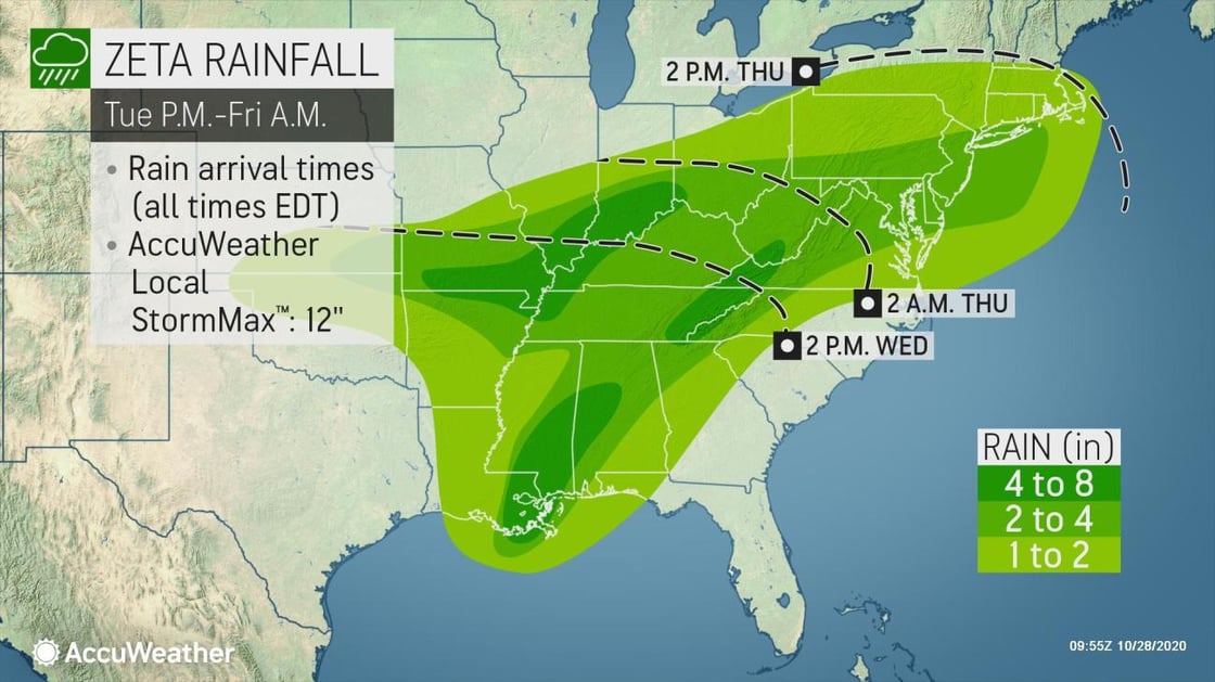
Moisture from Zeta will eventually cause heavy rainfall as far north as the Ohio and Tennessee Valleys, mid-Atlantic, Great Lakes, and the Northeast by Wednesday night into Thursday night as Zeta combines with another non-tropical storm that will race eastward from New Mexico and Texas.
At this point, widespread rain amounts of 2-4 inches are anticipated across much of the Deep South extending northeastward into the mid-Atlantic, Northeast, Ohio, and Tennessee Valleys from Wednesday through Friday.
Locally heavier amounts of 4-8 inches with an AccuWeather Local StormMax™ of 12 inches of rainfall can occur near where Zeta makes landfall along the Gulf Coast as well as across the Ohio Valley and parts of the central and southern Appalachians, where flash flooding and mudslides in the higher terrain may cause road closures.
In parts of the Ohio Valley into the mid-Atlantic and Northeast, where many leaves are still falling and have yet to be cleaned up, leaf-clogged storm drains can exacerbate street flooding in many urban areas. Even in rural areas, culverts and drainage ditches can become obstructed and overflow.
Considerations to add to your Emergency Action Plan with COVID-19
- Business continuity when employees are working from home
- Geographical dispersion of staff in the event of an evacuation
- Ensure employees are personally prepared
- Onsite operational needs and preparations