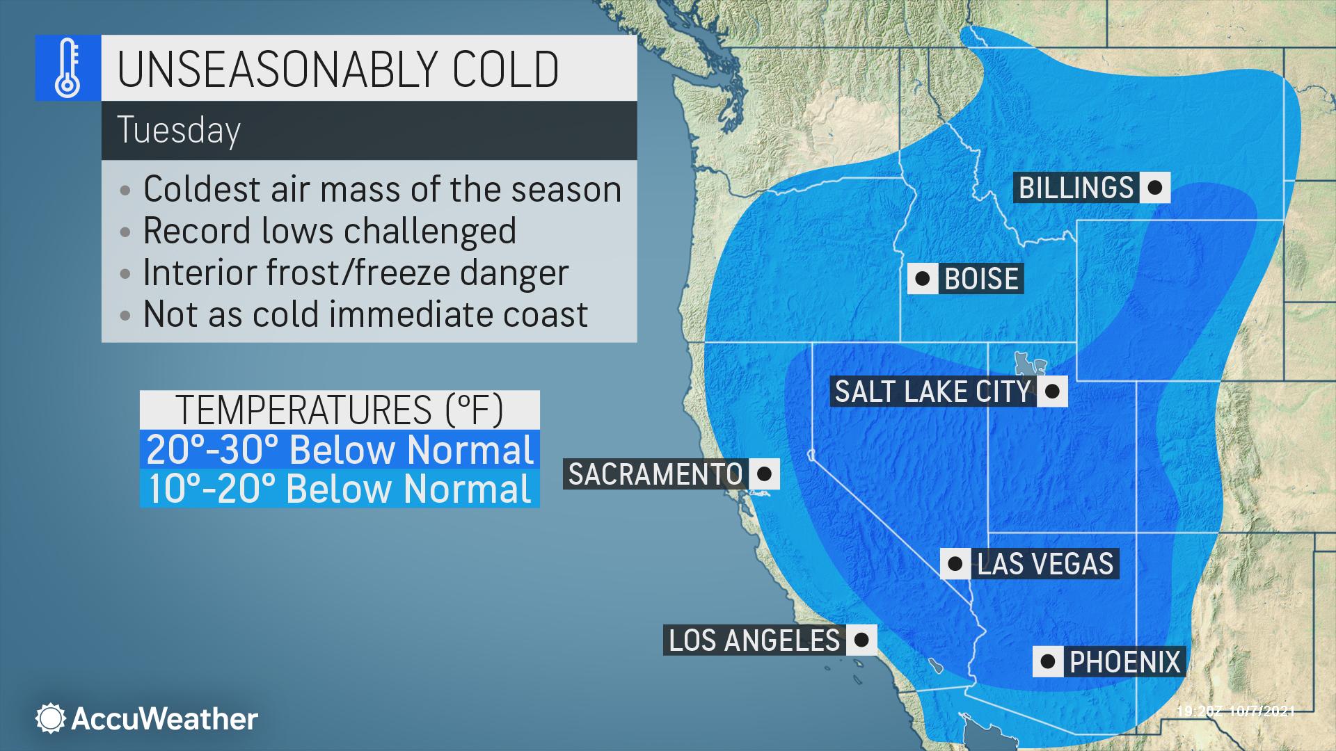
Tumbling Temperatures
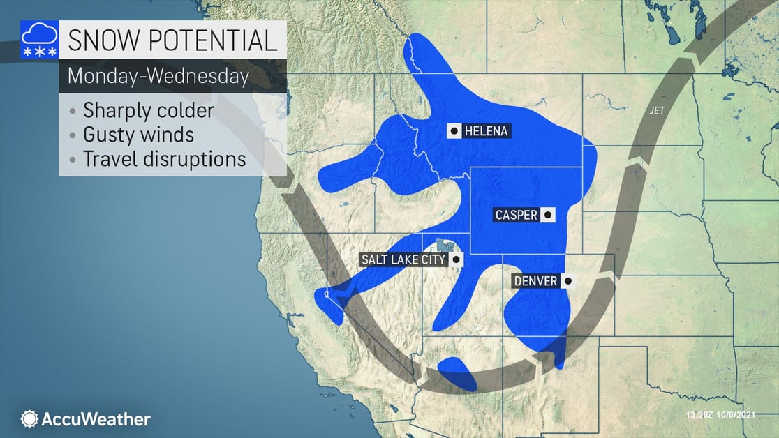
Get your jackets and shovels ready. A powerful early-season storm is bringing snow to the Rocky Mountains, along with some serious winter hazards. The strong cold front will roll in on Sunday, then move south and east on Monday, causing a major drop in temperatures across the Northwest and Rockies. By Tuesday, temperatures could dip down as much as 30 degrees below normal, challenging record lows in the area. Snow, high winds and blizzard conditions are also expected to pound the region, which saw summer-like temperatures just last week.
The snow is expected to start on Sunday night in the higher elevations of the Rockies and Sierras. Up to 24 inches could fall in the higher elevations of eastern Wyoming. Dangerous blizzard conditions will begin Monday night across central Wyoming and far south-central Montana, with expected wind gusts over 40 mph and whiteout conditions.

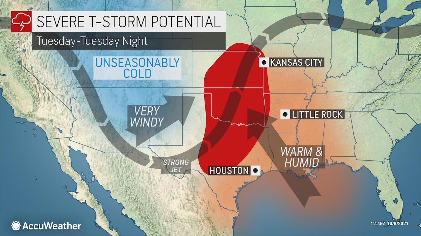
At the same time, a separate system will bring dangerous severe weather across the Plains. Starting on Sunday through Tuesday, severe storms with isolated tornadoes, wind gusts up to 70 mph, and local flash flooding can develop over the Southern Plains. The storms will then move northward and eastward overnight into the Central Plains and portions of far western Missouri and Arkansas.
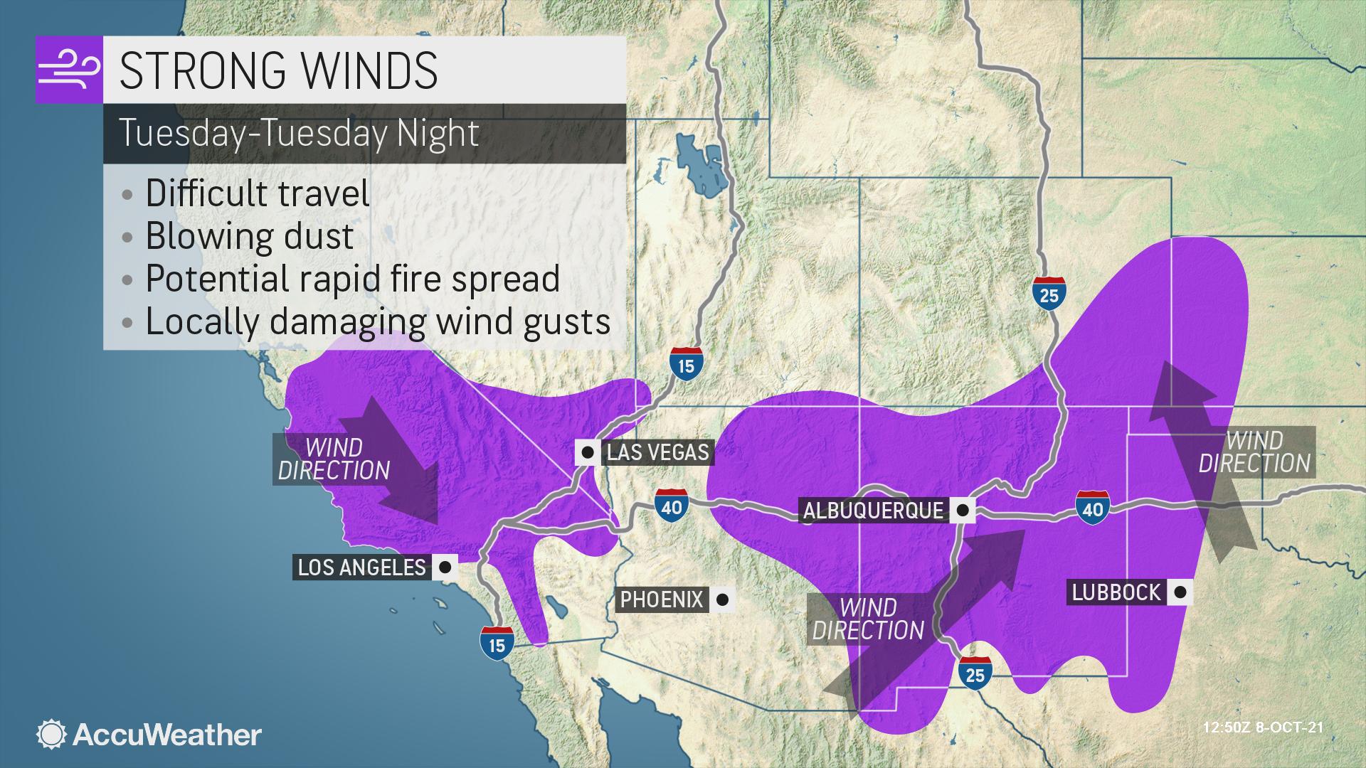
In portions of the Southwest and southern Plains, the problem will be gusty winds. Strong winds are expected Monday from southern California and southern Nevada, into eastern Arizona and much of New Mexico into Tuesday. The winds will shift into eastern New Mexico, West Texas, the Oklahoma Panhandle and southeastern Colorado later on Tuesday night. The powerful gusts will bring with them an increased risk for wildfires, property damage, and travel interruptions.
Businesses in this region need to keep a close eye on this system and should:
- Expect ground logistics disruption due to road closures along portions of I-10, I-15, I-40 and I-70 due to strong winds and blizzard conditions
- Prioritize cold weather concerns for essential outdoor workers and ensure company vehicles are equipped for severe winter weather. This should include a snow scraper, blanket, first aid kit and flashlight
- Be prepared for power outages and lengthy closures
- Establish an emergency communication plan and share with it your staff before the storm
Don't let winter worries slow you down this snow season. When the worst weather hits your area, be prepared with AccuWeather Snow Alerts. Our new service provides the most accurate snow alerts and forecasts with proven Superior Accuracy™, all focused on your precise locations.