Hope Springs
Last week marked Groundhog Day when Punxsutawney Phil emerged from his burrow and declared six more weeks of winter, but that may not be the case for the entire country. While Spring officially begins March 20, there is still plenty of winter weather in the pipeline but it's not all bad news. AccuWeather's team of long-range forecasters, led by Senior Meteorologist Paul Pastelok, has been analyzing weather patterns around the globe and they have your forecast for the coming months so you can better prepare your business.
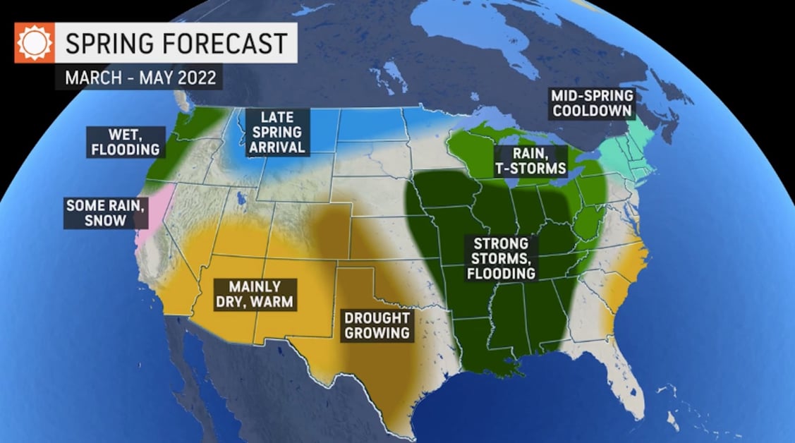
Northeast, Midwest: It's been a bitterly cold winter for this region with Chicago setting a new record for its latest-ever first measurable snow of the season. Our long-range forecasters predict cold air will once again bring the chill in either late March or April. The mid-spring cooldowns will bring the potential for frost and freezes about one or two weeks later than normal, potentially impacting when farmers and gardeners decide to plant for the season. The return of colder air will also open the door for snowstorms to deliver plowable snow over the Northeast as late as April.
Southeast: An early tropical system may be the wild card for this region. The Atlantic hurricane season does not officially start until June 1, but a storm could spin up before the season gets underway. Pre-season tropical systems have not been out of the ordinary as of late, with a named storm developing in either April or May every year since 2015. This could happen again this year anywhere from Florida to the Carolinas in May or early June.
Northwest, Southwest: A stormy pattern is projected to start in February and into March, delivering much-needed precipitation to this drought-stricken region. Most of those storms will be directed at the Pacific Northwest and away from Southern California and the interior Southwest which need it the most. Some moisture could make it into the interior Southwest if a few storms take a more southerly track in March and even as late as April, but it will not be enough to alleviate the long-term drought.
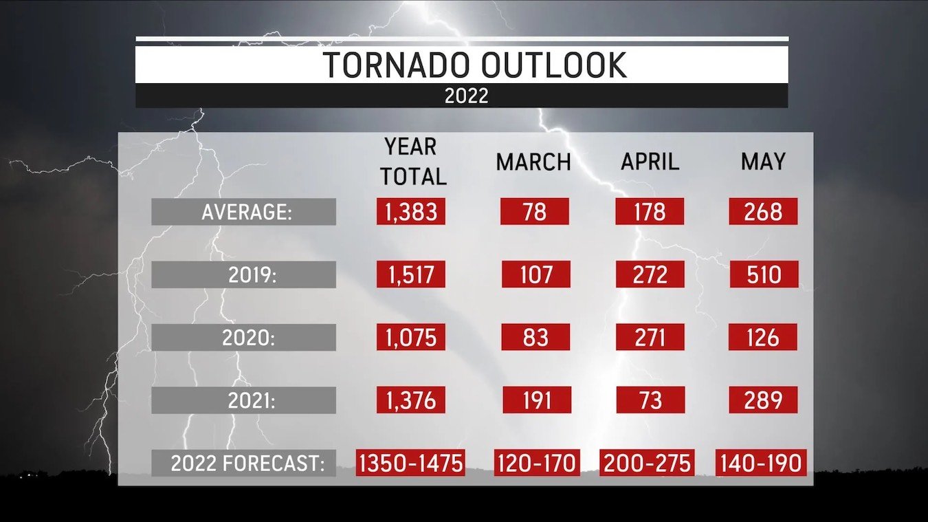
Spring also means the start of severe weather season. This year, the worst of the storms and tornadoes may once again focus on areas outside of the traditional Tornado Alley. The highest risk of damaging thunderstorms and tornadoes in March, April, and May will focus on the Gulf Coast states, Tennessee Valley, mid-Mississippi Valley, and the Ohio Valley. This includes major cities like St. Louis, Kansas City, Indianapolis, Nashville, and Cincinnati.
For more on what’s ahead this spring and what’s left for this winter check out AccuWeather's Groundhog Day: Winter Update Webinar. Our lead U.S. Long-Range Forecaster, Paul Pastelok, shares his updated winter forecast with a spring forecast preview. Plus, AccuWeather For Business Expert Paul Drewniak discusses the unique challenges businesses face before, during, and after severe weather impacts your area.