Cross-country Trouble
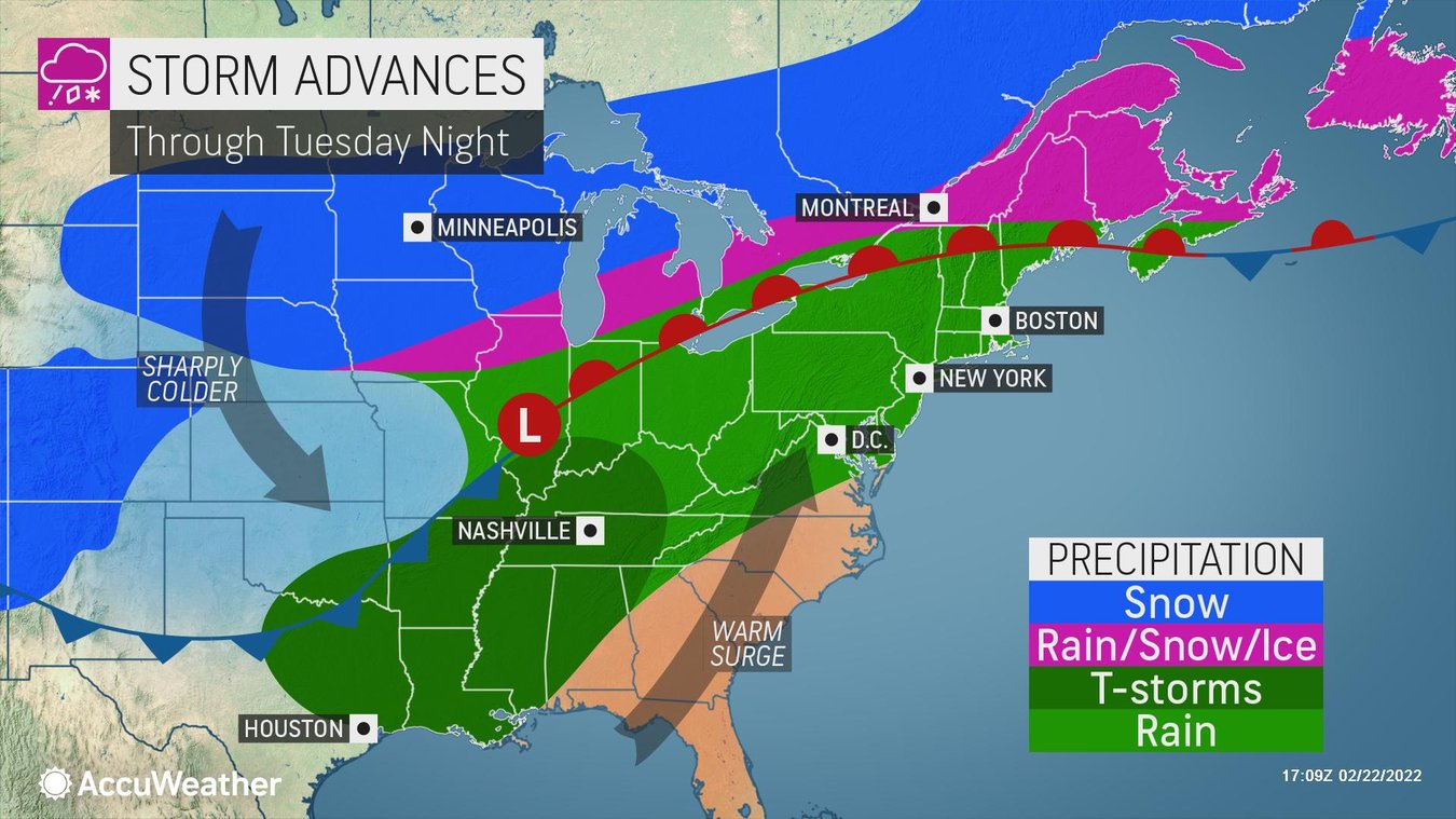
Not one but two storms are forecast to take a cross-country journey during the week ahead, bringing with them snow, wind, ice, and rain. The first storm, which began Monday, advances into the Northeast Tuesday with snow to the north and rain from lower portions of the Northeast through the Tennessee Valley. Southerly winds will bring warm Gulf moisture into the lower Mississippi Valley Tuesday afternoon, which could lead to severe weather in the region. Isolated tornadoes, gusty winds, and flash flooding are all possible. As it exits, the storm will leave bitterly cold air in the northern Rockies and adjacent Plains, where temperatures can drop as much as 50 degrees Fahrenheit below normal.
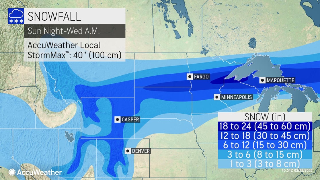
Snow is expected Tuesday and Tuesday night in the Southwest from Southern California to Flagstaff and the southern Wasatch Range. This could lead to some substantial delays in travel. The snow will slowly clear out west to east through the day Wednesday to Wednesday night with an AccuWeather Local StormMax™ of 40 inches.
A second storm will emerge into the Southern Plains Wednesday into Thursday, bringing freezing temperatures through central Texas into the middle Mississippi and Ohio valleys along with dangerous icy conditions. Cities like Dallas, Tulsa, and Little Rock are under a high risk of significant icing, which can cause power outages farther south, from the Lower Mississippi to Tennessee Valleys, flooding rainfall and severe weather are expected.
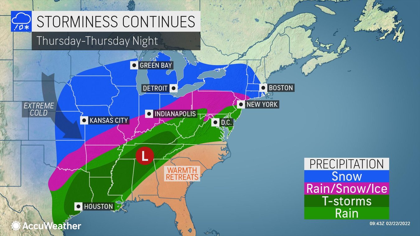
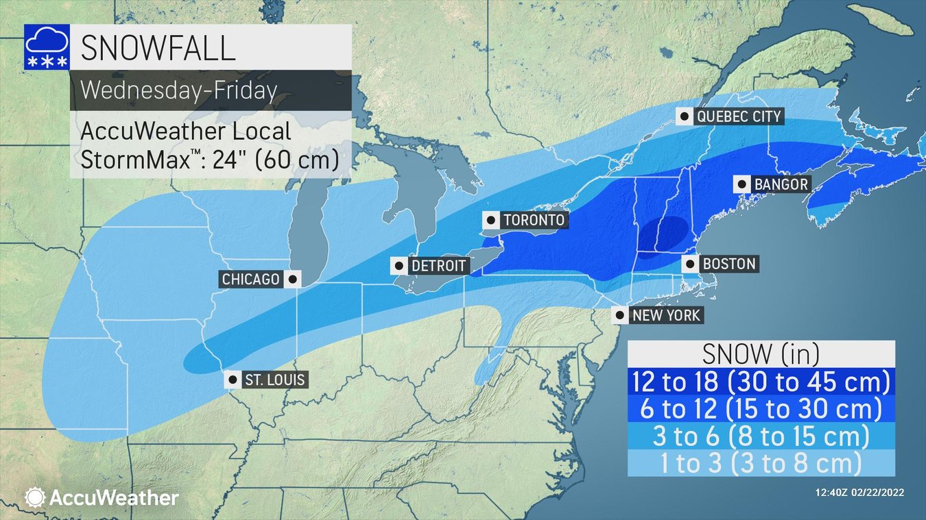
This storm will move into the Northeast Thursday and Friday, potentially bringing a wintry mix from Ohio and Pennsylvania to far southern New England, with the heaviest snow possibly falling from upstate New York through central New England.
Businesses in the area need to keep a close eye on this system and should:
- Expect business interruption due to power outages
- Disruptions to ground logistics due to road closures and icy/snow-covered roads
- Prioritize cold weather concerns for outdoor workers
- Ensure all employees and visitors on-site have a way to be notified of severe weather
When winter weather strikes - Partner with us
Trust our experts to help you make critical decisions with confidence whenever snow and ice threaten, starting with AccuWeather Snow Alerts™ delivered straight to your inbox. Take a step up with 1:1 business weather expert support with our Snow Warning Service. Or cover everything you need around the globe in all types of weather with SkyGuard® Severe Weather Warnings.