Snow and Ice Ahead
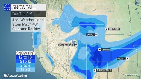
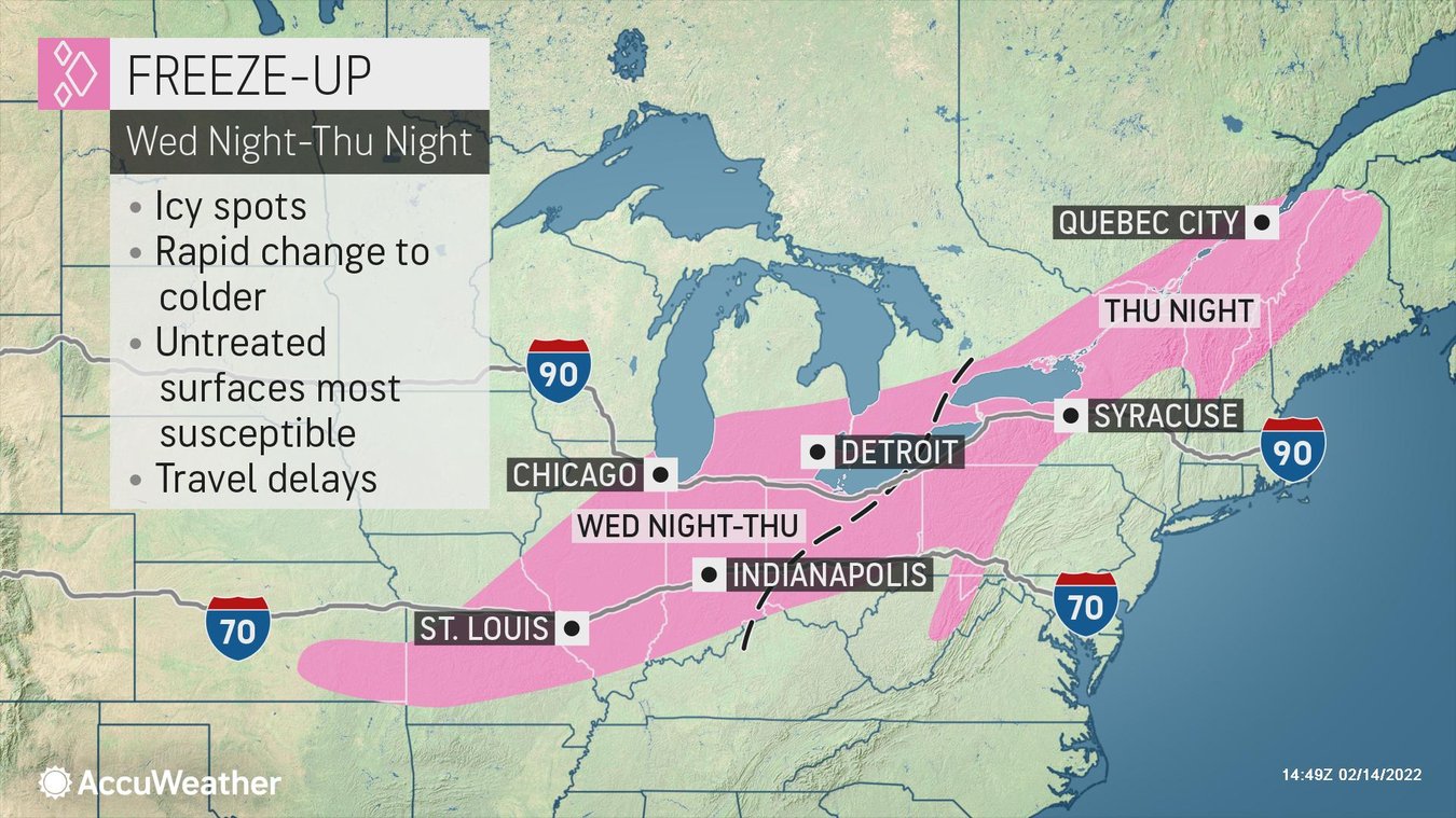
With cold air to the north and west and record warm air to the south and east, the storm is anticipated to quickly strengthen and move eastward into the Ohio Valley by Thursday afternoon and eastern Canada later in the week. The system is forecast to bring with it snow, gusty winds, and falling temperatures. Across the West, heavy snow is expected across the Rockies, as well as from eastern portions of the central Plains through the Great Lakes and eastern Canada. Heavy rain will threaten the lower Mississippi Valley to parts of the Northeast and severe weather in the southern Plains to Tennessee Valley, as well as a rapid freeze-up during and behind the storm as it crosses from the Midwest into northern New England.
As the storm moves into the Plains Wednesday, there is the potential for a narrow zone of freezing rain to occur across portions of the middle Mississippi Valley extending into the southwestern Great Lakes. Temperatures will drop very quickly across the Midwest to the Great Lakes Thursday to Thursday night, which may cause a dangerous freeze-up ahead of the morning commute for areas like St. Louis, Chicago, and Buffalo. Ice jams will also be possible across the Northeast into next weekend, which could worsen any river and stream flooding that may occur.
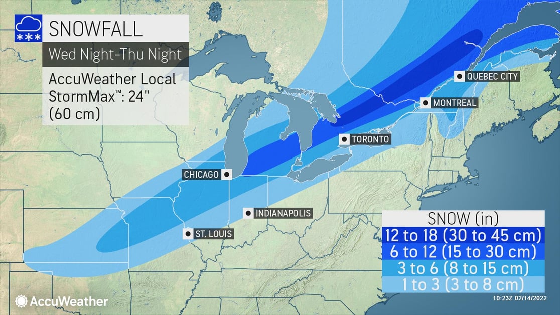
As the storm strengthens and moves into the Mississippi Valley Thursday, snow is expected from the central Plains through eastern Canada. Up to 1 inch per hour of snowfall could bring travel and logistical operations to a crawl from Kansas City to Chicago. More than 6 inches of snow is expected from Michigan to southeastern Canada with an AccuWeather Local StormMax™ of 24 inches.
From the Plains to the Great Lakes, heavy snow is expected to disrupt travel and logistical operations. Gusty winds behind the storm could produce near-blizzard conditions at times. Businesses in the area need to keep a close eye on this system and should:
- Expect business interruption due to power outages
- Disruptions to ground logistics due to road closures and snow-covered roads
- Prioritize cold weather concerns for outdoor workers
- Ensure all employees and visitors on-site have a way to be notified of severe weather
When winter weather strikes - Partner with us
Trust our experts to help you make critical decisions with confidence whenever snow and ice threaten, starting with AccuWeather Snow Alerts™ delivered straight to your inbox. Take a step up with 1:1 business weather expert support with our Snow Warning Service. Or cover everything you need around the globe in all types of weather with SkyGuard® Severe Weather Warnings.