A destructive derecho tears through the Midwest; AccuWeather provides its clients with the most advanced warnings
Posted by
Elizabeth Potts
Summary
When a rare derecho struck several states in the MidWest, AccuWeather provided more advanced notice, a more accurate forecast, and better descriptions of impacts than any other weather service.
Key Highlights
AccuWeather’s severe weather outlook correctly identified the zone of greatest concern, which was nearly identical to the actual derecho path
AccuWeather meteorologists provided 40 minutes greater advance notice on the intense wind when compared to the government and other sources
SkyGuard® clients on average receive weather warnings 2x faster than public alerts
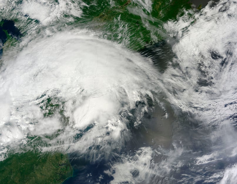
Derecho Danger
On July 5, 2022, severe weather, including a rare derecho, ripped through South Dakota, Iowa, and Illinois. AccuWeather for Business forecasters uniquely warned of this specific threat and provided more advanced notice, a more accurate forecast, and better descriptions of impacts than any other weather service provider.
The most advance notice:
- Over a week before the derecho, on June 27, AccuWeather’s Long Range Forecast Team accurately predicted the possibility of severe storm potential across the Plains and Midwest on July 5.
- On June 30, 5 days before the event, our Long Range Forecast Team reiterated the threat to AFB clients by issuing content across all our digital properties. No other weather source highlighted this risk.
The best description of impacts:
- As the event unfolded on July 5, AccuWeather forecasts for the region impacted accurately predicted that “thunderstorms can produce destructive winds, damaging hail and flash flooding.”
- Before the storm officially was classified as a derecho, AccuWeather proactively communicated to users and media that this was a “derecho in the making.”
The most accurate forecast:
- On July 4, AccuWeather provided an in-depth Latest Extreme Weather Update (LEWU) highlighting the damaging thunderstorm risk over the next several days. This included mentioning the potential for a wide swath of destructive winds. Additionally, over 24 hours before the derecho, AccuWeather’s severe weather outlook correctly identified the zone of greatest concern with a “moderate” area that extended from South Dakota into Illinois. This was nearly identical to the eventual derecho path.
- On the morning of the derecho, July 5, AccuWeather upgraded to a “high” risk along the derecho’s predicted path in advance of the government and other sources by at least an hour.
- As the thunderstorms began quickly intensifying and producing destructive winds, AccuWeather meteorologists issued warnings providing much greater advance notice and accuracy than any other source. There were numerous instances where AccuWeather meteorologists provided 40 minutes greater advance notice on the intense wind when compared to the government and other sources. Additionally, other warnings did not accurately predict the magnitude of the imminent wind risk. For example, AccuWeather meteorologists warned of winds up to 100 mph in some areas, while the government warned of winds up to 70 mph. In at least two cases, peak winds of 99 mph and 96 mph were observed, with winds over 70 mph lasting for 20-30 minutes. AccuWeather SkyGuard® customers and users of the AccuWeather Alert™ service received these warnings.
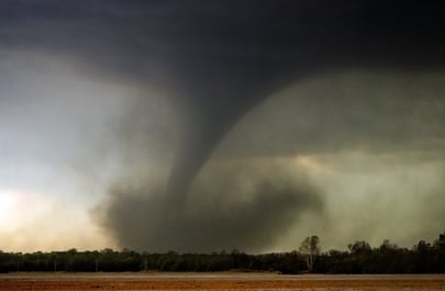
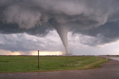
Additionally, associated with the same weather pattern that produced the derecho, a few tornadoes occurred further south and east. AccuWeather meteorologists provided warnings well in advance of other sources and in at least one case when no other warning was issued proactively:
- In Goshen, OH, two injuries were reported and significant property damage was reported due to a tornado with peak winds of 130 mph on July 6. AccuWeather meteorologists detected this immediate tornado risk sooner than any other source. They issued a tornado warning that provided 8 minutes of advance notice. The government did not issue a tornado warning until the tornado was already on the ground causing serious damage.
- In Harwood, MD, on July 5, AccuWeather meteorologists detected an immediate tornado risk. They issued a tornado warning which provided 31 minutes of advance notice, a full 20 minutes before the government tornado warning that was later issued.
Stay safe with SkyGuard® Warnings:
- Proactive, site-specific alerts offer advance warnings well before severe weather impacts occur
- Live one-on-one or group consultation is provided by our weather experts anytime, day or night
- Reviewed tornado notifications advise when a government-issued tornado warning is in effect but there is no threat to your asset location
- Alerts are delivered in a format that aligns with your organizational emergency management plan
- All-clear notifications are delivered when a threat is over, minimizing weather-related downtime
- All alerts are delivered via push notification from the SkyGuard mobile app, available on Android and iOS