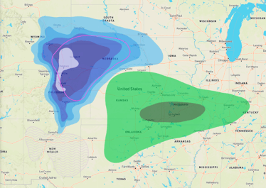
Dangerous Severe Setup
An extremely dangerous situation is set to unfold across the south today into tonight, with all types of severe weather expected. Much of this area was impacted by severe storms last week.
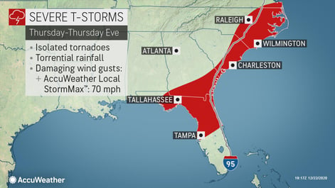
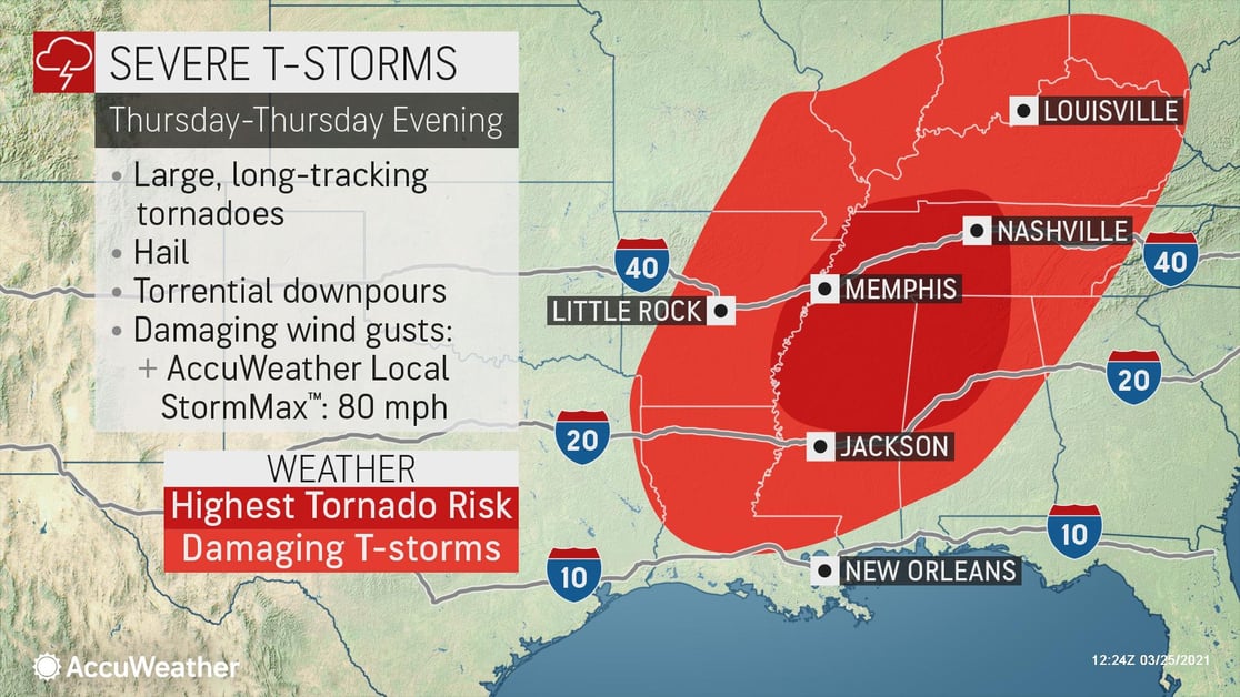
All severe hazards can occur during this event, including hail, damaging winds and tornadoes, with the highest risk of tornadoes across portions of western and middle Tennessee, far southwestern Kentucky, northern Alabama, northern and central Mississippi and far eastern Arkansas Thursday afternoon and evening
Violent Tornadoes and Damaging Winds
The environment is favorable for any tornadoes that form to be large, long-tracked, and violent, so it is imperative to know where the place of shelter or refuge is within your business and ensure all persons on-site are able to safely reach and stay within shelter for the duration of the tornado warning.
Supercell storms today are also capable of producing damaging wind gusts up to 80 mph, which should be responded to in the same manner as a tornado threat, given the potential for lofted and wind-driven debris.
Large Hail
Large hail of 2 inches in diameter is also expected today, along with the threat of lightning from any storm that forms. Outdoor workers should have a way to receive warnings or be notified of impending threats and have a hardened place to shelter, keeping in mind that large hail can easily shatter windshields and roofs of vehicles.
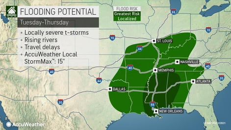
Flash Flooding
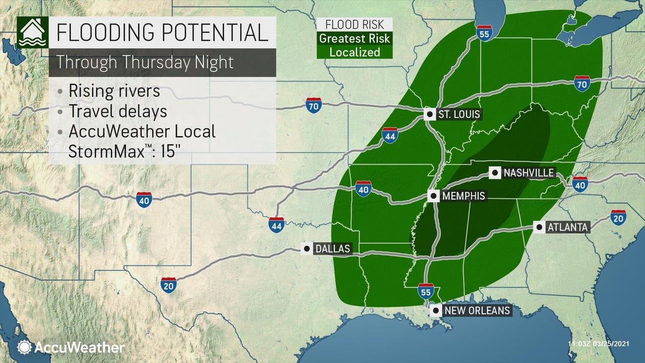
There is a widespread risk of flooding with this strengthening system as storms produce extremely heavy rainfall from the South through the Tennessee Valley and Ohio Valley. Rivers and creeks are likely to overflow, producing flooding in adjacent areas, along with localized street flooding.
The greatest risk for flooding to occur will be from central Kentucky southward to Mississippi, Alabama and Louisiana, including cities like Nashville, Memphis, and New Orleans. Rainfall amounts of up to 15 inches are possible through tonight. These storms will pose a significant threat to life and property, as well as the potential for prolonged business disruption. Make sure your organization is fully prepared for severe weather by incorporating site-specific alerts into your emergency procedures.
Protect your employees and assets by signing up for a SkyGuard demo today.
- Expect ground logistics disruption due to downed trees and power lines, especially along portions of I-20, I-40, and I-55
- Damaging hail could impact outdoor activities, equipment and inventory
- Temporary structures designed for COVID-19 response will be especially at risk from high winds, tornadoes and hail
- Protect your company against liability by ensuring all employees know the actions to take during severe weather
- Identify time needed for equipment shutdowns and travel times to shelter
- Storm shelters should be well-marked and equipped with a disaster supply kit
- Integrate protective actions directly into warning messages