Christmas Eve: Drenching rain, gusty winds, thunderstorms to threaten businesses
Summary
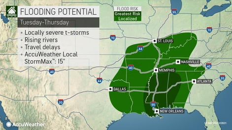
Heavy rain, gusty winds and even some locally strong thunderstorms will threaten to dampen the holiday.
Key Highlights
Threats: Heavy rain, strong thunderstorms, locally damaging winds, isolated tornadoes
States affected: NC, SC, AL, GA, FL, MS
When: December 24
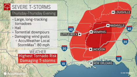
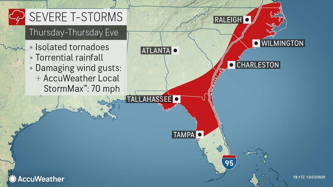
Stronger storms look to move through Alabama, Georgia, Florida and the Carolinas Thursday into Thursday night. These storms will bring a threat for wind gusts of up to 60 mph, heavy downpours and even an isolated tornado as the strong cold front moves eastward.
- Tornado potential should be watched closely; keep sheltering options in mind
- By Christmas Day, cold air could cause rapid freezing and travel delays in the Carolinas
- Business interruption due to localized power outages can be expected
- Temporary structures, especially those designed around COVID-19 response will be especially at risk with high winds
Over the Southeast U.S., strong thunderstorms may cause localized wind damage and isolated tornadoes over the eastern Carolinas on Thursday. Areas from Mississippi and Alabama eastward to the Carolinas will have to be on guard for these feisty storms. Damaging wind gusts look to be the main threat at this point, but there could also be a threat for tornadoes.
Those taking their holiday celebrations outdoors in the warm and breezy Christmas Eve afternoon or evening in the Southeast should keep an eye on the sky and make sure they can seek safe shelter quickly should inclement weather strike.
The strongest winds will be right at the coast, where the wind will also generate rough surf and some coastal flooding, especially at times of high tide.