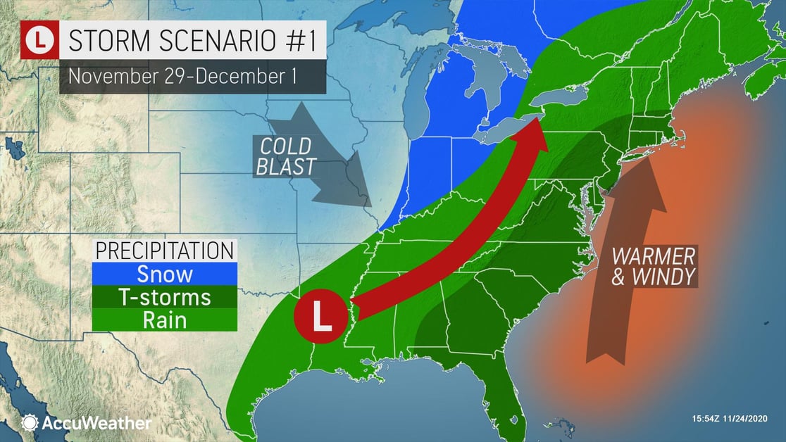
One of two scenarios will unfold early next week as people return from the Thanksgiving holiday. Take precautions now to stay ahead of the storm.
A variety of weather threats can be expected as the storm arrives, bringing damaging winds, severe weather, and even winter impacts.
- Temporary COVID-19 response structures will be especially at risk in high winds
- Businesses with weather exposure: Life safety and asset protection should be top of mind
- Protect your company against liability by ensuring any employees driving in bad weather on company time are trained in safe, cautious driving techniques and know the actions to take in the event of an accident
- Establish an emergency communication plan. Share employee, client, and vendor contact information before the storm and disseminate the plan to critical staff
- Expect widespread travel delays if traveling home after the long holiday weekend or heading back to work or school
Depending on the strength and track of a storm forecast to evolve over the southern Plains or the upper Gulf coast on Sunday, there is the risk of all types of weather early next week. Expect severe weather in the Southeast states, heavy rain from the Southeast states to the Midwest and Northeast – all accompanied by a broad area of gusty winds.
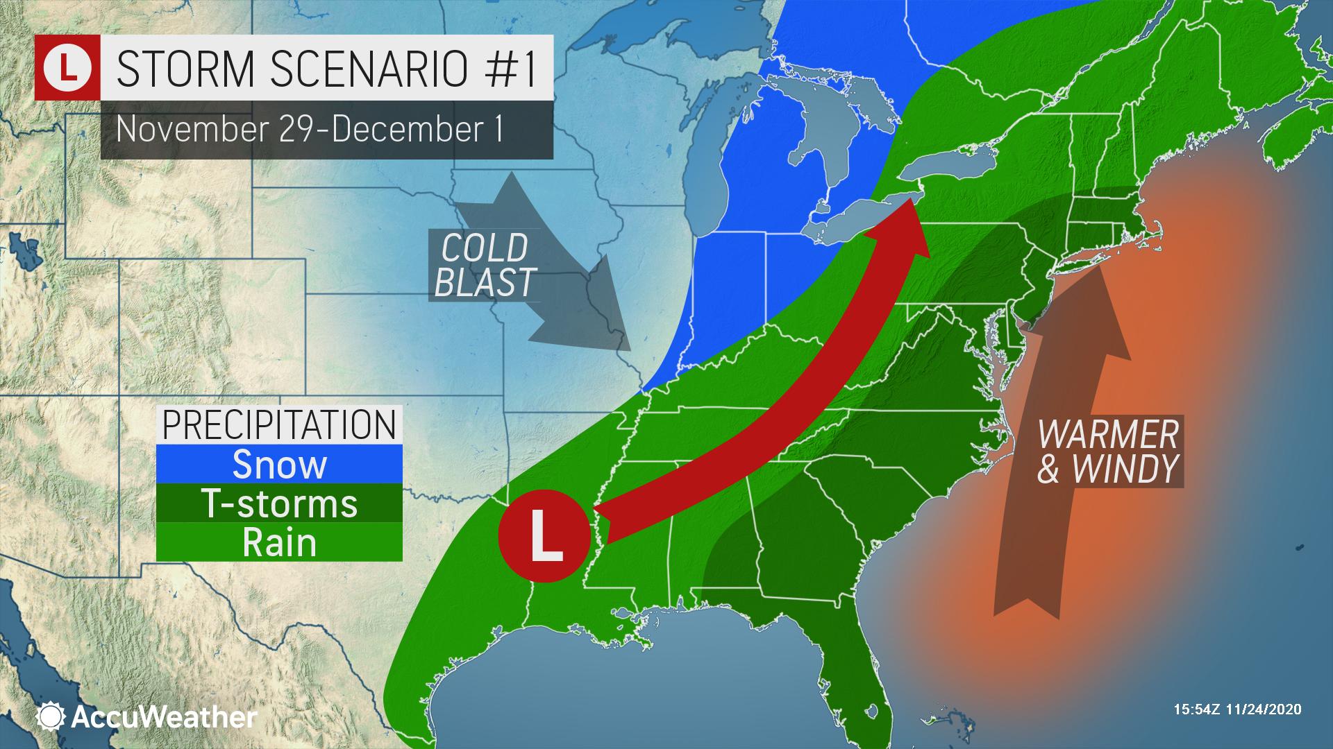
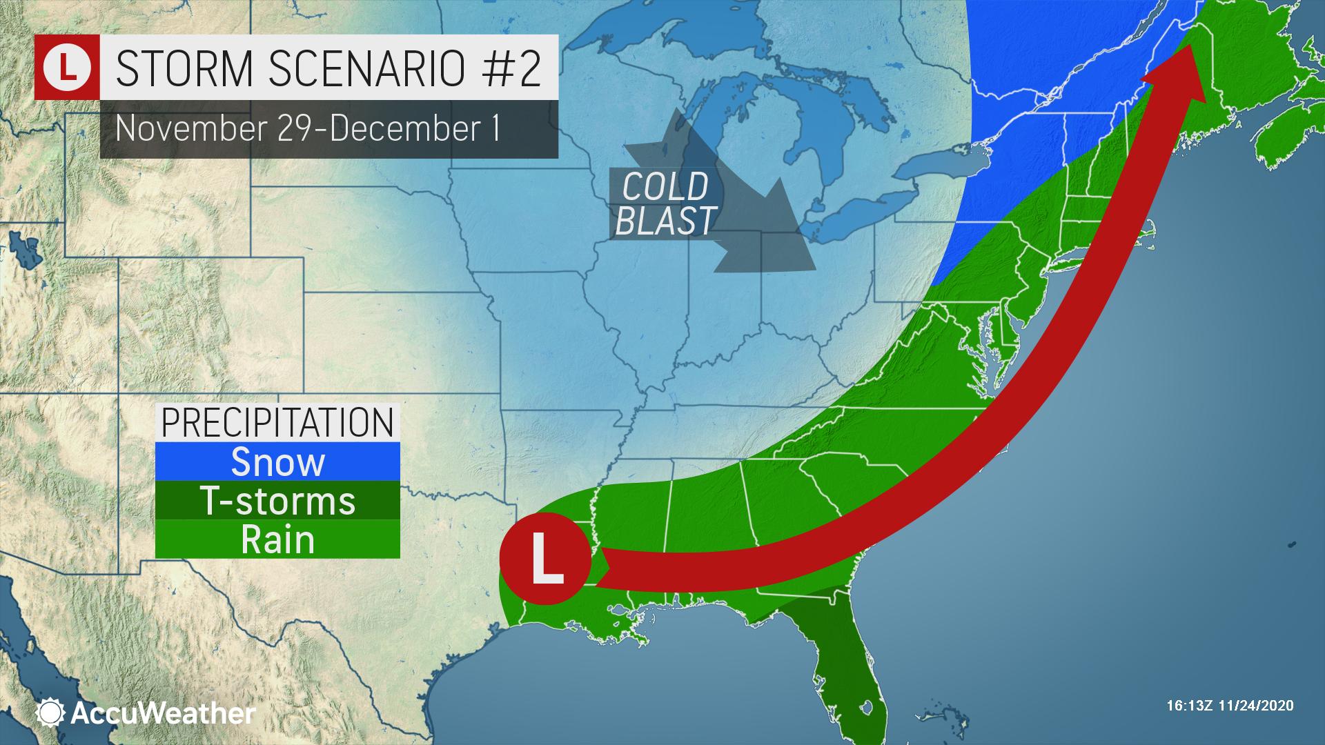
Should this storm develop to its full potential, a significant severe weather outbreak is possible in the Southeast. Flooding rain will disrupt the East, along with the possibility of winds strong enough to cause sporadic power outages. A swath of snow may develop on the storm's cold side from the Tennessee Valley and/or Ohio Valley to the Great Lakes or interior Northeast.
In any case, an outbreak of colder air will invade the Central and Eastern states with lake-effect snow from northern Michigan to parts of West Virginia, western Maryland, Pennsylvania, and New York state with the duration and magnitude dependent on the storm’s strength.
Details will unfold in the coming days on the storm’s intensity and extent of weather-related issues.