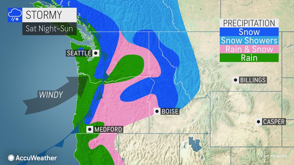
The stormiest stretch looks to be from Saturday night through the end of next week. During this period, there may be as much as five storms moving crashing ashore.
- Potential for debris slides, especially in burn scar areas
- Expect ground logistics and travel disruption, road closures, downed trees, and power outages especially along portions of Interstates 5 and 90 due to snow covered roads, poor visibility and strong winds
- Protect your company against liability by ensuring any employees driving in bad weather on company time are trained in safe, cautious driving techniques and know the actions to take in the event of an accident
- Retail: Shovel and salt walkways, dry high traffic areas inside near your entrance, put up “Wet Floor” signs, and keep all floors clear to help prevent falls and reduce liability
- Temporary COVID-19 response structures may be at risk due to high winds and heavy rain and snow
- Ability to exercise safe outdoor dining options may be minimal
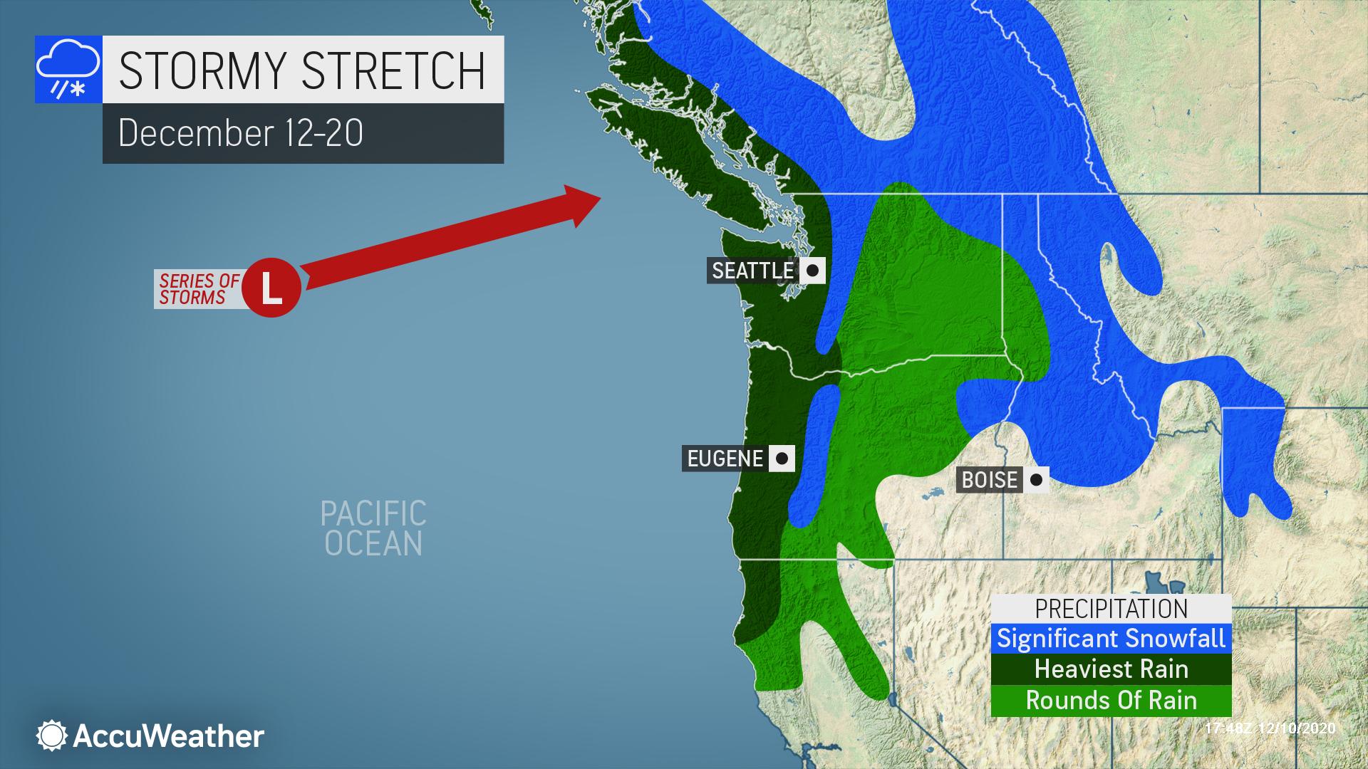 Beginning this weekend, the period lasting through mid-December will likely start with a bang as a powerful storm appears likely to pound Washington and Oregon with high winds, heavy rain and mountain snow.
The first major storm may deliver 1-3 inches of rain along the coasts of Washington and Oregon, while heavy snow will fall in the Cascades as snow levels fall by early Sunday. Colder air trapped in the lower elevations at the onset of precipitation could lead to a period of freezing rain and slippery travel east of the Cascades.
The result of all this storminess will likely be rounds of heavy rainfall and potential flooding from western Washington to extreme northwestern California.
In the mountains, several feet of snow may accumulate during the period with the potential for hazardous driving conditions due to snow covered roads, poor visibility and strong winds. Many ski areas in the Northwest should quickly add to their current snow bases.