A large storm is forecast to bring heavy rain followed by bitter cold and snow from Christmas Eve to Christmas Day.
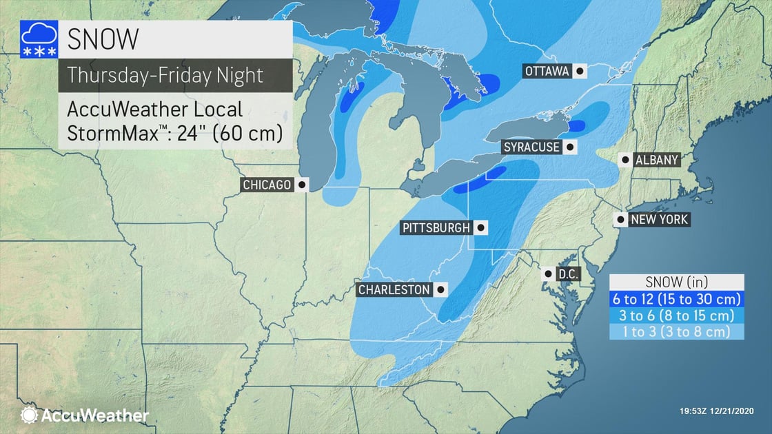
Snowfall
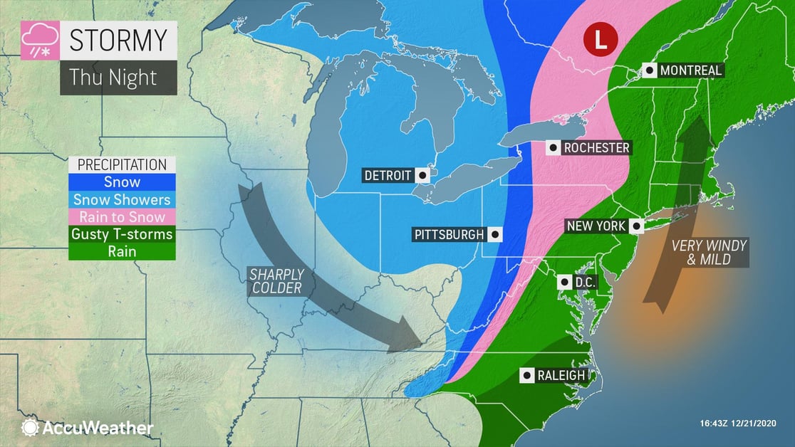
Snow will begin from the Appalachians through the Ohio Valley Thursday morning, and in the Northeast Thursday evening. The heaviest snowfall of 12-18 inches with rates to 3"/hr at times will occur along the shores of Lake Erie and Lake Ontario with lake effect snowfall. Snow will taper off across the Upper Midwest through the Appalachians by Thursday evening and the Northeast by Friday morning.
Following the cold air, rain is expected to change to snow over parts of New England with lake-effect snow over parts of the Great Lakes. By late Friday night many areas in the eastern Great Lakes will have 1-3 inches of snow with the snow belt areas to the southeast of Lake Erie and Lake Ontario expected to receive 6-12 inches. The AccuWeather Local StormMax™ is 24 inches.
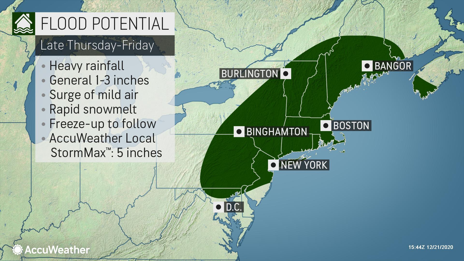
Rainfall
Heavy rainfall will occur across much of the Northeast Thursday morning through Friday morning. Totals of 1-3 inches will fall at rates to 0.5"/hr at times with an AccuWeather Local StormMax™ of 5 inches. Rain is expected to surge northward from the Middle Atlantic states to New England Thursday into Thursday night and will be heavy at times. Due to last week’s heavy snowfall, areas saturated with ongoing snowmelt – from northeastern Pennsylvania and northern New Jersey through much of the Northeast into central Maine – will be faced with urban and low-lying flooding concerns. A significant portion of the deep snowpack over the interior Northeast is expected to be washed away by early Christmas morning.
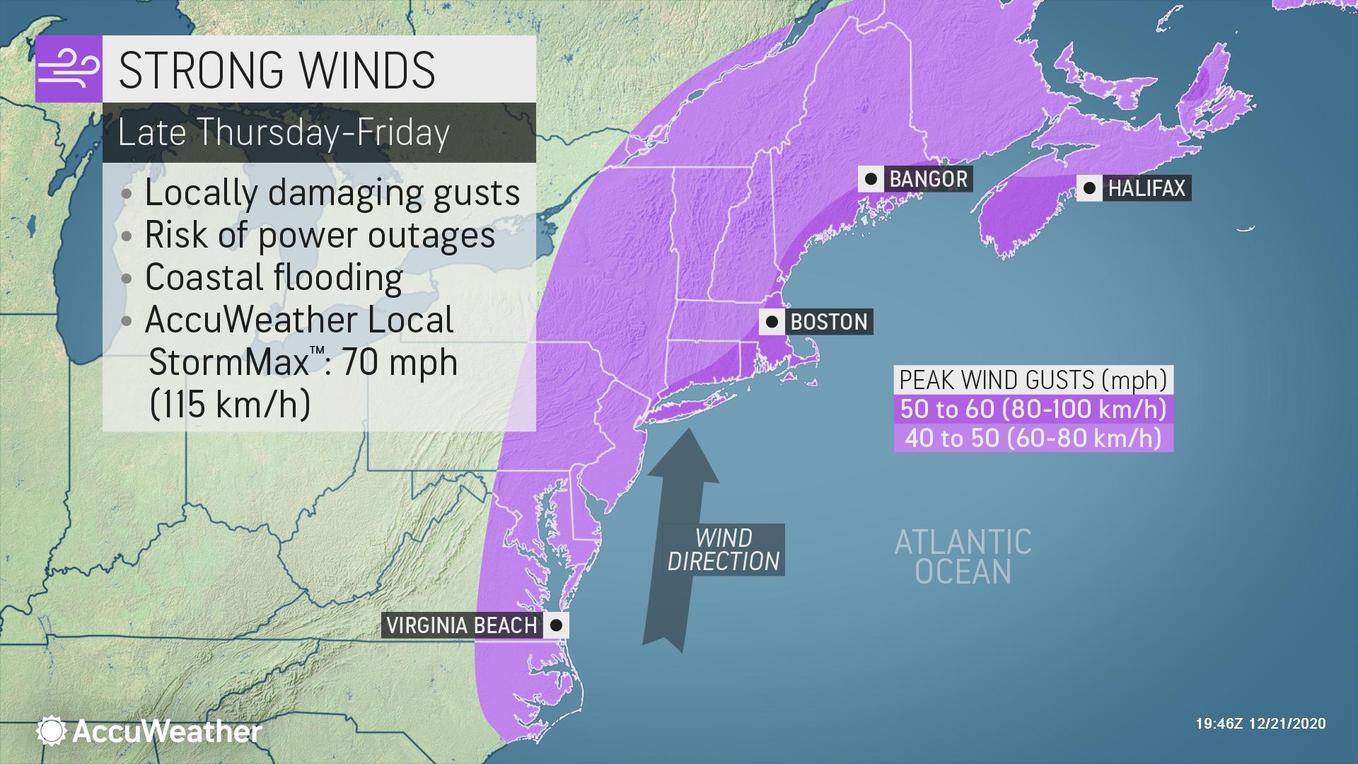
Wind
In addition to the rain, strong winds are expected to impact the region. Along the East Coast ahead of the strong cold front, southerly winds will usher in gusts of 50-60 mph with an AccuWeather Local StormMax™ of 70 mph. The winds could also lead to coastal flooding and beach erosion. Winds will diminish by Friday evening as the cold front pushes eastward.
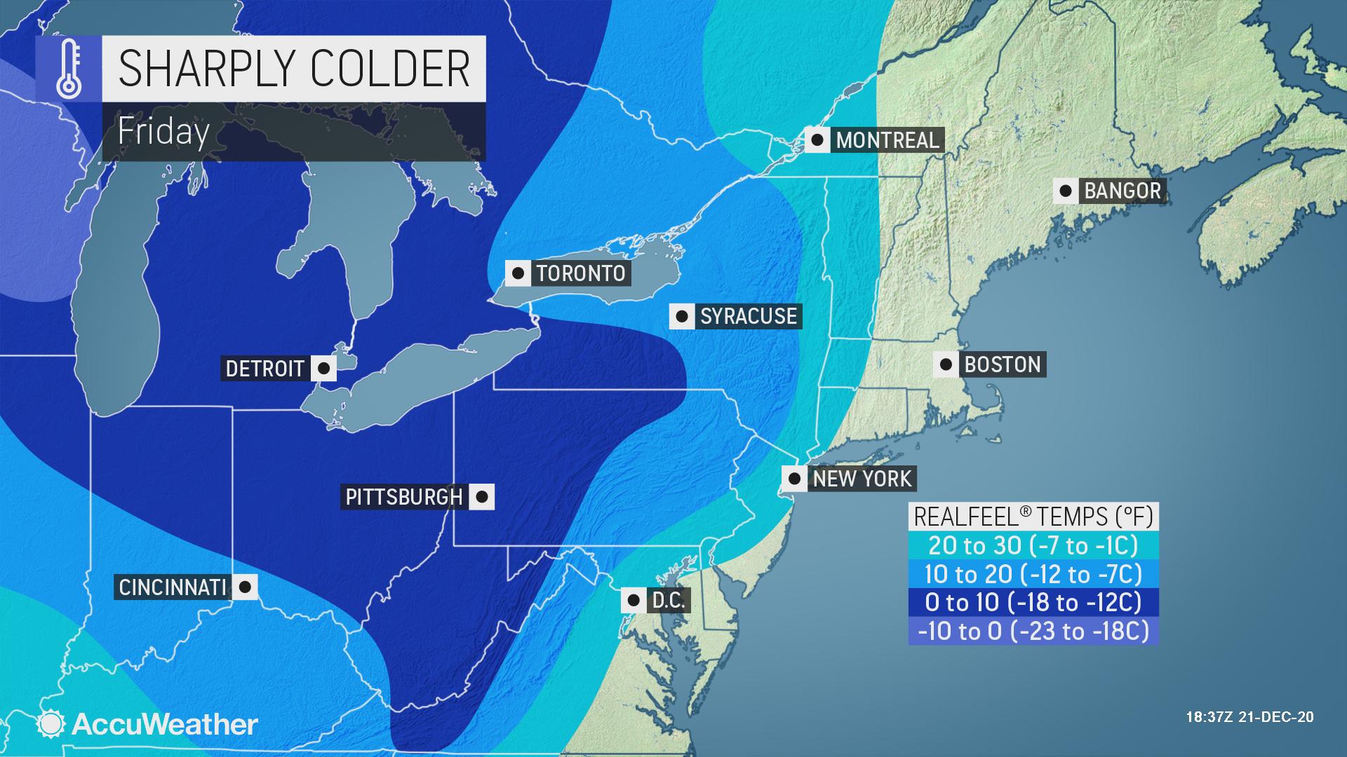
Extreme Cold
The combination of wind and Arctic air will make it feel very cold from the Midwest to the Appalachians late Thursday into early Friday. Temperatures could be more than 10-15 degrees below average from the Midwest through New England. Any snow combined with standing water, slush and plummeting temperatures can lead to rapid freezing of surfaces and dangerous road conditions from the Appalachians westward.
- Interstates potentially impacted by flooding rainfall in the Northeast include I-90, I-95, I-80 and I-84. Stream and river flooding along with ice jams and ponding of water is expected to cause significant travel delays on Christmas Eve
- Road and rail washouts are anticipated with heavy rain and snowmelt
- Expect disruptions to logistical operations, as well as road and interstate closures from heavy snow, which could cascade into package deliveries expected before Christmas Day
- Businesses should prepare for power outages due to high winds
- Fog could cause low visibility Thursday into Thursday night, adding to travel problems
- Air travel could see delays or cancellations with flights grounded due to a combination of strong winds, heavy rain and snow. Further delays are possible as planes will need to be de-iced and runways may turn slick with the push of colder air and snowfall behind the storm