A disruptive winter storm will impact the Midwest into the Mid-Atlantic and Northeast, bringing snow, sleet, and freezing rain to a significant portion of the country.
Snow
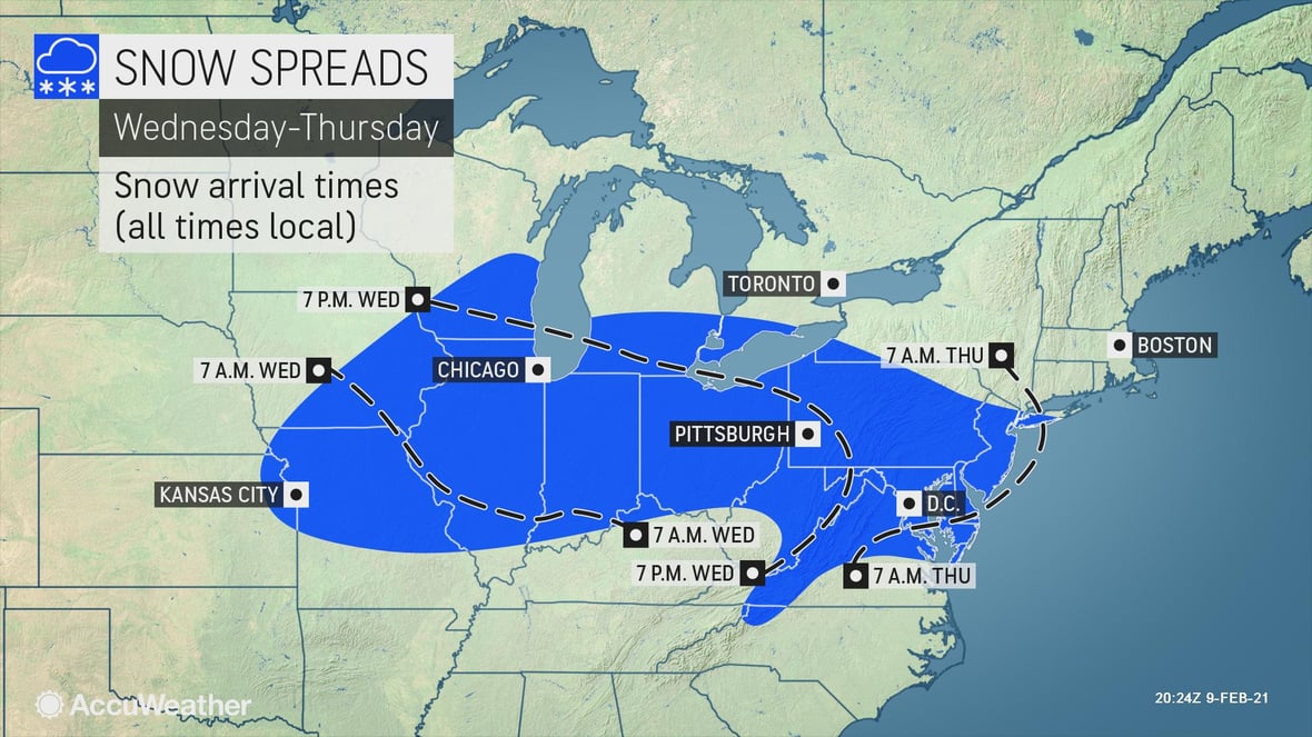
After a quick-hitting storm to start the week, a longer-duration winter event is expected to produce accumulating snow from the Midwest into the Northeast. Snow will spread from west to east starting on Tuesday, with a broad swath of 1-3 inches expected from Kansas City, reaching the mid-Atlantic by late Thursday. Higher amounts of 3-6 inches are expected in a narrow swath from northeastern Missouri, east through central Illinois across Indiana into Ohio, as well as from northern West Virginia through much of Maryland, D.C., Delaware, New Jersey, and southern Pennsylvania.
A smaller area of 6 to 12-inch amounts are forecast from the mountains in the panhandle of West Virginia through western Maryland, southern Pennsylvania, and southern New Jersey. The AccuWeather Local StormMax™ for this storm is 24 inches.
Freezing Rain
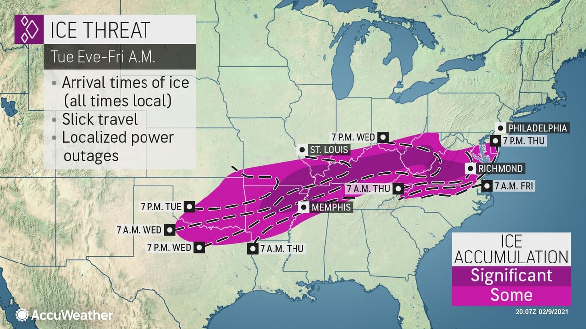
A significant ice event is expected as this storm pushes from west to east over the nation from Tuesday through Thursday night. Any amount of ice can cause slippery travel and delays, but the area of heaviest ice is expected over northeastern Arkansas, southeastern Missouri, Kentucky, West Virginia and western Virginia, where over 0.25 of an inch of ice can accumulate. This can bring power outages and disrupt travel for days.
- Ice accumulating on tree branches as well as power lines may lead to downed trees and power outages and ultimately business interruption
- Snow may fall on areas that already have significant snow cover from recent storms across the Midwest and mid-Atlantic
- Widespread, significant travel delays are possible over multiple days in many places. Interstates most likely to be significantly impacted on Tuesday-Wednesday: I-40, I-70, and I-64. Impacts on Thursday-Friday will shift to I-80, I-70, I-81, and I-95
- Be prepared for lengthy closures. Take this time to review policies and communicate with employees to confirm your organization handles this storm as best as possible