AccuWeather For Business Clients Prepared For Hurricane Impacts
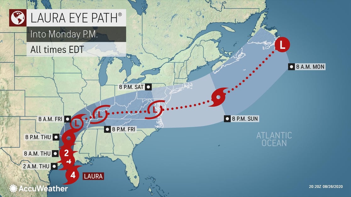
Hurricane Laura made landfall at peak intensity with maximum sustained winds of 150 mph, slightly shy of a Category 5 storm. It was the first time on record that a Category 4 hurricane made landfall in southwestern Louisiana, and its 150-mph wind speed has it tied with the 1856 “Last Island” storm for the strongest landfalling hurricane in the state's history.
Over a 10-day period, AccuWeather For Business meteorologists provided almost 100 live conference calls for clients for both Marco and Laura in a variety of industries, including manufacturing, telecommunications, education, retail, insurance and transportation. Our expert meteorologists began informing clients on Monday, August 24 that Laura could hit as a Category 3 hurricane, and eventually a Category 4 storm during calls on Tuesday, August 25. By relaying this information more than 24 hours before other sources, AccuWeather For Business clients were provided more time to prepare their organizations than non-client organizations.
An Emergency Operations Manager at a major railroad company said, "Kudos to your storm warning meteorologists. Your briefings are assisting our operations leaders with assessing event impacts. For us it is a complicated scenario as these trains depart two days prior to their arrival in the storm impact area."
Due to the multifaceted risks associated with this tropical system, AccuWeather For Business clients utilized AssetReport™ to monitor multiple risks and assets simultaneously. The report gives clients the ability to hone in on various weather impacts at each location they care about, including the start and end times of tropical-storm-force winds in relation to those assets, a feature only offered by AccuWeather For Business.
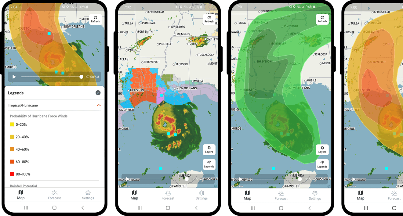 Marco... Laura
Marco made landfall near the mouth of the Mississippi River on August 24, just hours before weakening into a tropical depression. Impacts from the storm were felt along the coast from Louisiana to the Florida Panhandle ahead of landfall in the form of rough surf and gusty downpours.
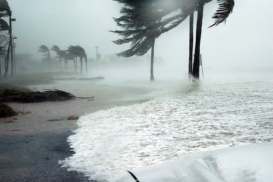
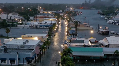
Despite Marco’s decrease in intensity, Laura spun into the central Gulf Coast right on Marco's heels, making landfall as a Category 4 hurricane (sustained winds of 130-156 mph) on Thursday, August 27 at 2 a.m. ET near Cameron, Louisiana. The storm caused catastrophic damage due to wind and storm surge across the region, including in the city of Lake Charles, where wind gusts over 140 mph were reported.
Hurricane Laura Timeline
- August 10: The AccuWeather Long-Range Forecasting Team highlighted the threat for development in the Caribbean which would eventually affect the Gulf during the August 20-29 timeframe. This notification enabled clients to begin to monitor the threat
- August 16: AccuWeather warned a tropical wave coming off the African coast could develop by August 21
- August 19: AccuWeather predicted Laura to make landfall in Louisiana while public sources were stating it was “too soon” to know its impacts on the U.S.
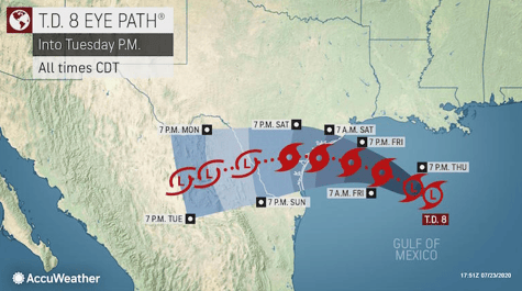
- August 20-21: Tropical Depression 13 upgraded to Tropical Storm Laura on the 21st. The other area farther west became Hurricane Marco
- August 27: Landfall near Cameron, Louisiana
Accurate Predictions for Rain, Wind and Storm Surge During Laura
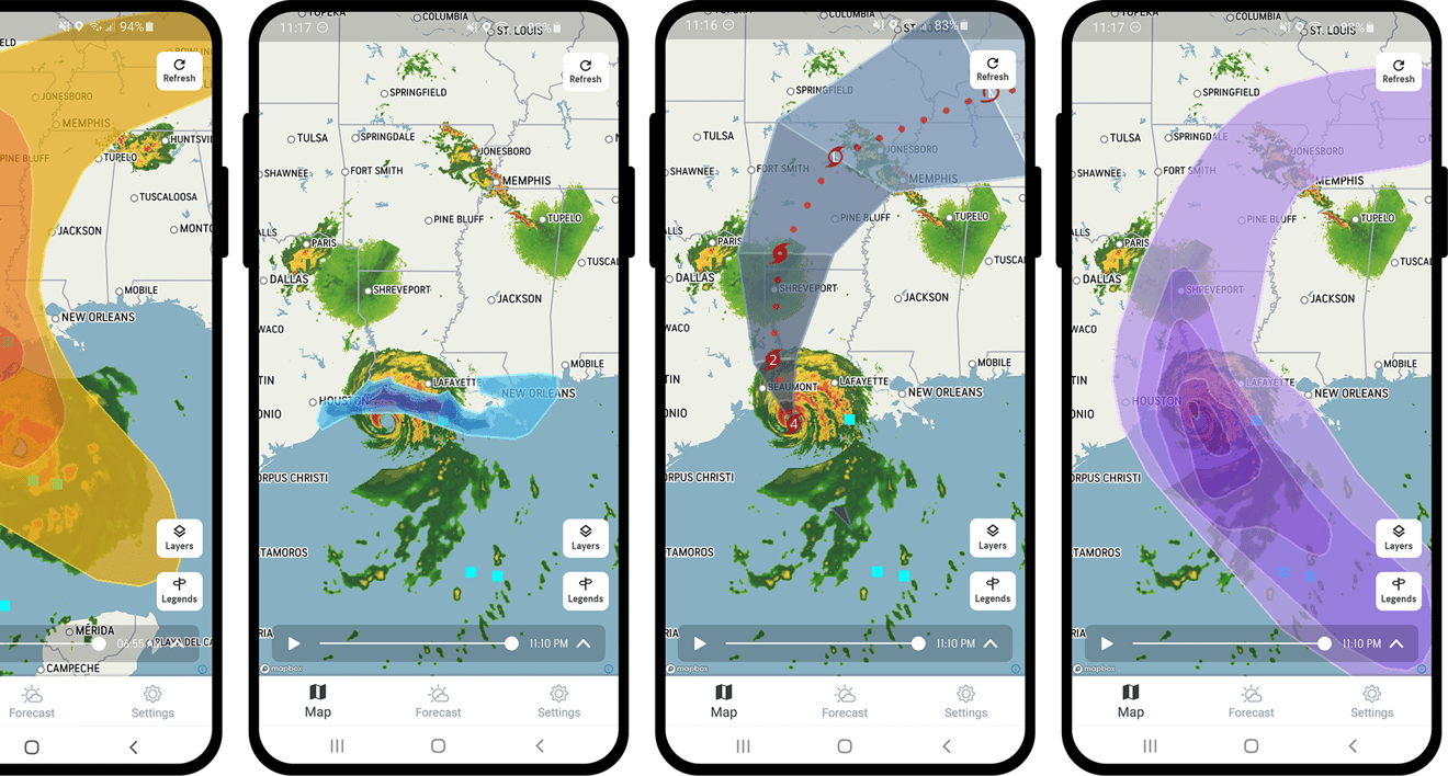
AccuWeather had the best and most accurate rainfall forecast for Hurricane Laura. There were widespread rainfall totals of 4-8 inches with an AccuWeather Local StormMax™ of 12 inches. These lower rainfall amounts were more accurate than the much higher rain totals predicted by other sources.
Clients were alerted to storm surge greater than 10 feet in portions of Louisiana as well as damaging winds. AccuWeather Local StormMax gusts of 140 mph were observed around Lake Charles. Clients were also warned of widespread power outages unusually far inland across Texas, Louisiana, Mississippi, and Arkansas along with wind gusts over 40 mph that extended well eastward into the Tennessee Valley.
AccuWeather RealImpact™ Scale for Hurricanes
Due to its storm surge, rainfall, and potential for catastrophic wind damage, AccuWeather rated Laura as a 4 on the RealImpact Scale for Hurricanes on the morning of Wednesday, August 26.
Despite the same rating as the Saffir-Simpson Wind Scale, which classifies storms by wind speed only, the AccuWeather RealImpact Scale is based on a broad range of important factors. In order to better communicate a more comprehensive representation of the potential impact of a storm to lives and livelihoods, the scale covers not only wind speed but also flooding rain, storm surge, and economic damage and loss. Some of these hazards such as inland flooding and storm surge in many storms result in more deaths and economic loss than wind.
AccuWeather estimated the total damage and economic loss caused by Laura will be $25 billion to 30 billion.
Advantages of our Hurricane Expertise, Tools and Services
Knowing the potential risks well ahead of any tropical system is an important part of developing, maintaining, and executing an organizational emergency action plan for the tropical season. Your plan, combined with early warning from AccuWeather for Business will save property and profits. Our flagship SkyGuard® service includes:
- A team of meteorologists watching out for you and your assets 24/7/365
- Ability to consult with a meteorologist for extra insight when critical decisions are necessary
- Tools to help you understand weather impacts ahead of other sources
- No-hype forecasts tailored to your operations and completely independent of public sources
Learn more about our hurricane forecasts and services or contact us for a no-obligation trial.