.jpeg?width=1300&name=page%20(6).jpeg)
Extreme Cold
Extremely cold air continues to surge southward, setting the stage for a one-two punch of winter weather that will bring snowfall from the Rockies to the Northeast and freezing rain from Texas to the mid-Atlantic.
Temperatures are forecast to dip to record levels in the 20s, teens and even the single digits in some cases by Saturday night in portions of Kansas, Oklahoma, Texas and Arkansas.
With many locations expecting record low temperatures, as well as snow and ice, businesses should make sure they are fully prepared for a major winter event.
- Turn off all exterior faucets so the pipes don’t burst when freezing
- Have flashlights and alternative communication devices easily available in case of power outages
- Ensure essential winter workers are equipped for severe winter weather. Vehicles should include a snow scraper, blanket, first aid kit and flashlight
- Plan ahead for employee safety, timing their travel around the timing of snow and ice
.jpeg?width=1300&name=page%20(5).jpeg)
.png?width=1920&name=image%20(12).png)
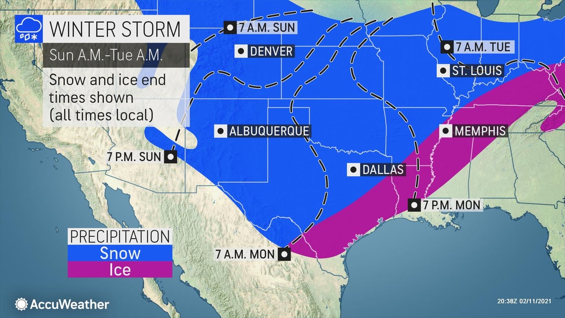
Snow
Snow will begin in the Rockies and Southern Plains on Saturday, spreading a swath of 6-12 inches across the Central U.S. into the Northeast by early next week. A bullseye of up to a foot and a half of snow is expected in northwestern Texas into central Oklahoma. High winds will also accompany the snow across eastern New Mexico, and western portions of Oklahoma and Texas. Travel will be impossible in that region on Sunday, with snowfall rates up to 1.5” per hour and wind gusts significantly reducing visibility.
There is still some uncertainty around the second storm, with two scenarios possible. Regardless of track, some form of snow, sleet, or ice is expected to hinder logistics and travel early next week across a large region from the Southern Plains into the Northeast.
Freezing Rain
Round one of freezing rain will wind down this morning across the Southern Plains, with the second, potentially more impactful round set to begin on Sunday across Texas and continuing into the Monday morning commute time frame. This event is likely to be extremely problematic, with freezing rain, sleet, and even wet snow potentially falling in places that are not accustomed to wintry precipitation. Even light ice accumulation will cause hazardous travel conditions. The heaviest icing of 0.10-0.25 inch will occur from the Tennessee Valley into the Mid-Atlantic.
AccuWeather For Business can provide your organization with site-specific snow and ice warnings, as well as high-level storm briefings that enable you to make informed decisions.
- Close to 20 million Americans throughout the country's mid-section can expect to be impacted by winter weather in the coming days
- Major disruptions to logistical operations are expected with lengthy travel delays due to hazardous road conditions
- Be prepared for extensive closures and take this time to review policies and communicate with employees to confirm your organization handles this storm as best as possible
- Temporary COVID-19 response structures and structures with large span roofs will be especially at risk in high winds and when snow load adds weight
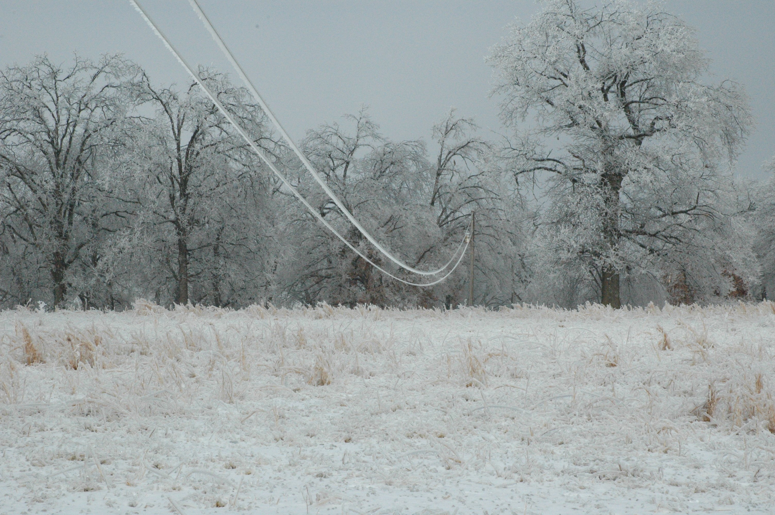
- Extreme cold, strong winds, and ice accumulating on tree branches and power lines may lead to power outages