Severe weather to impact central U.S. and mid-Atlantic through Thursday

Summary
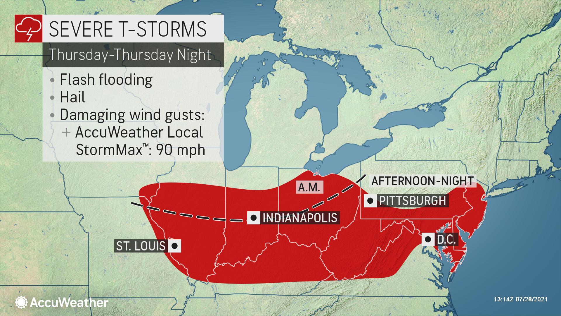
Rounds of severe thunderstorms are forecast to fire over the central U.S. and into the Mid-Atlantic tonight into Thursday.
Key Highlights
Threats: Destructive wind gusts, power outages, isolated tornadoes, hail, flash flooding
States affected: MN, WI, IL, MI, IN, OH, PA, WV, KY, MD, NJ, DE, VA
When: Wednesday, July 28 - Thursday, July 29
Dangerous weather ahead for the Midwest
A damaging round of storms is predicted to accelerate southeastward through portions of eastern Minnesota, much of Wisconsin, northern Illinois, northern Indiana, and central/southwestern Michigan into tonight.
This complex may evolve into a widespread damaging wind event, known as a derecho.
AccuWeather is projecting local StormMax™ wind gusts near 100 mph in some communities with the potential for regional power outages, falling trees, property damage and significant crop losses. Air travel disruptions are likely as the storms pass through major metro areas, including Chicago and Milwaukee, and perhaps for a brief time in Minneapolis and Detroit.
In addition to the high wind threat, some storms may include the risk of large hail, flash flooding and an isolated tornado.

Strong storms may erupt in parts of the mid-Atlantic, including the Washington, D.C. area on Thursday, with another round of heavy, gusty and locally severe storms also likely in parts of the Ohio Valley and Northeast.
AccuWeather Storm Warning Meteorologists have proactively prepared clients on this impending weather threat since Monday morning, alerting them to the widespread potential for damaging winds and risk of power outages.
- Expect ground logistics disruption due to road closures, downed trees and power outages
- Businesses with weather exposure: Life safety and asset protection should be top of mind
- Anticipate flight delays in major metropolitan areas
- Possible business interruption due to extended power outages


