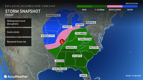
A flood of trouble
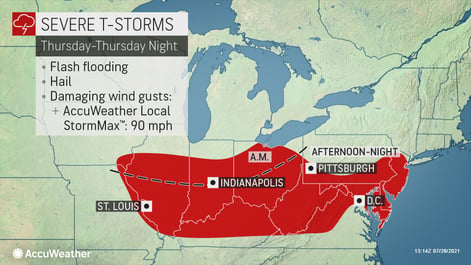
Severe storms are expected to start this afternoon across portions of the Ohio Valley into the Appalachians and continue eastward in the coming days. This system has the potential to produce isolated tornadoes and damaging winds with gusts up to 70 mph, and an AccuWeather Local StormMaxTM of 75 mph. However, flash flooding is the biggest threat to businesses and residents along its path. Up to 6 inches of rain is expected in some areas from Wednesday through Friday, with an AccuWeather Local StormMax of 8”.
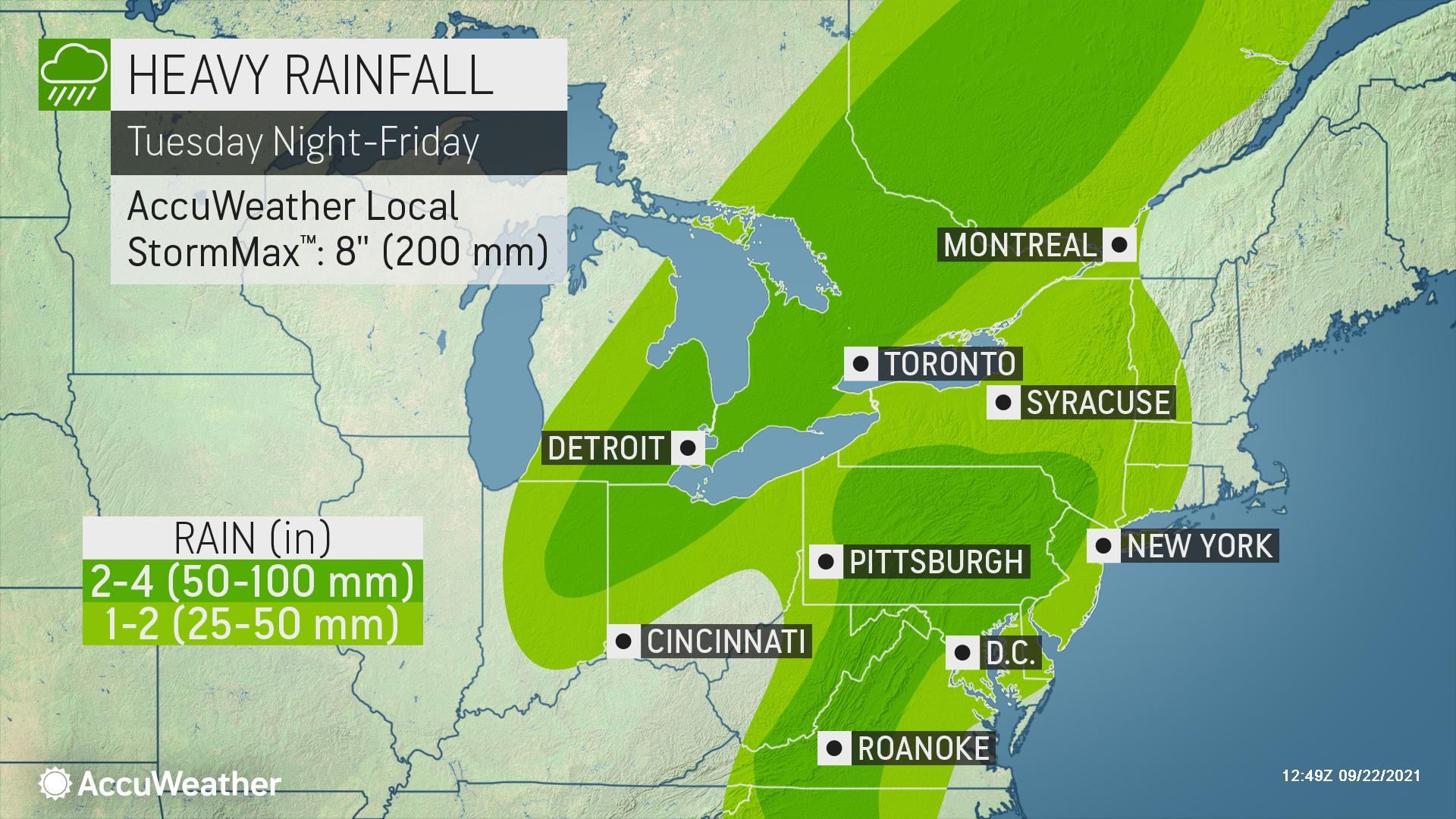
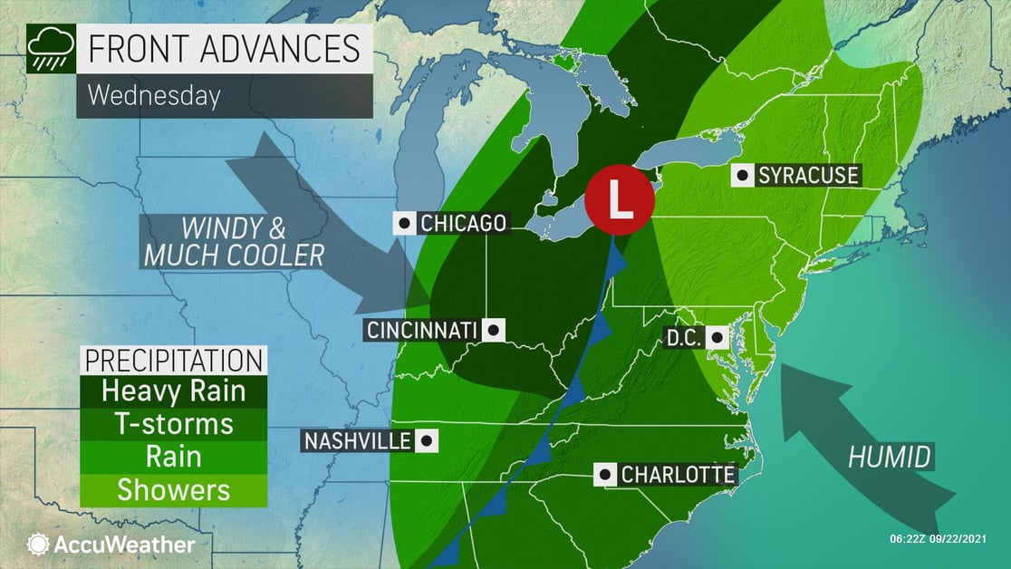
A developing low-pressure system is causing the cold front to slow down, making the rain even more problematic. In addition to this, high pressure just off the East Coast is acting as an atmospheric roadblock, causing the rain to last longer in many places and further increasing the flood threat.
- Business interruption due to extended power outages can be expected
- Expect ground logistics disruption due to road closures, downed trees and power outages
- Loss of Inventory due to flooding - If your warehouse is in a low-lying area, precautions should be taken
- Ensure all employees and visitors on-site have a way to be notified of severe weather