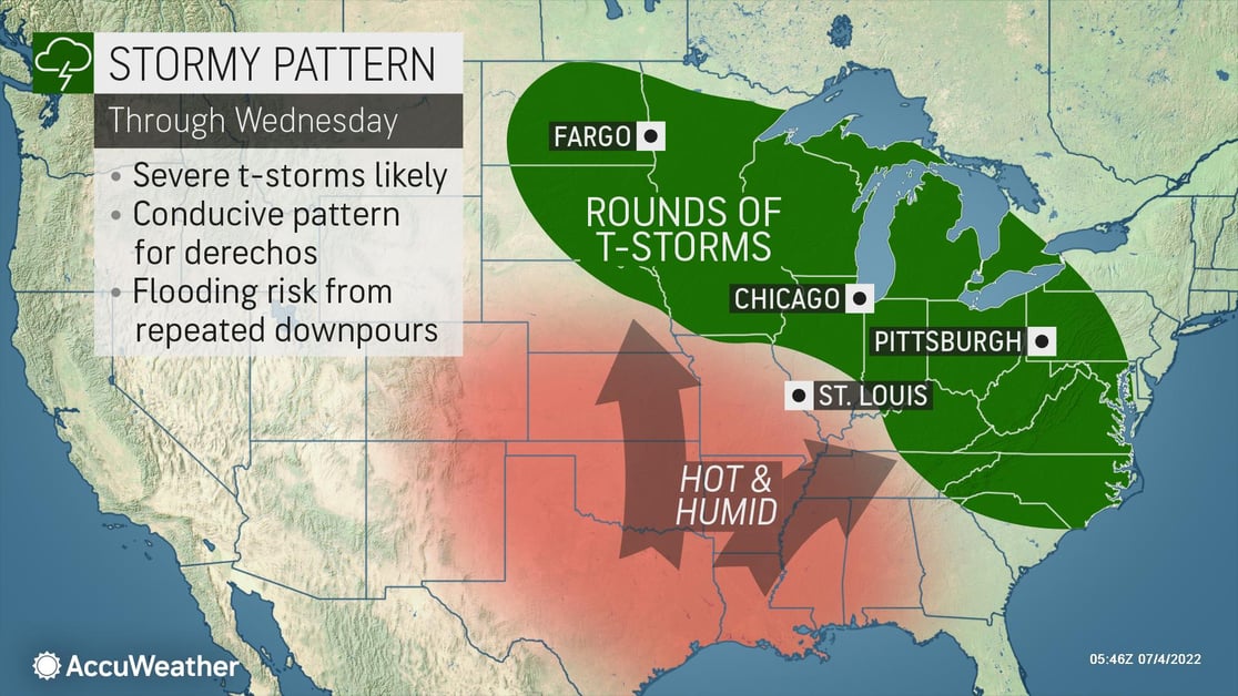
Stormy pattern back to back
From the Upper Midwest and Great Lakes across to the Mid-Atlantic, there is a multiday threat of severe weather expected across a wide swath of the central and eastern U.S. Thunderstorms capable of producing widespread wind damage, isolated tornadoes, flash flooding, and hail could impact major cities like Chicago, Milwaukee, Fort Wayne, Indianapolis, and Columbus, Ohio through Tuesday night.
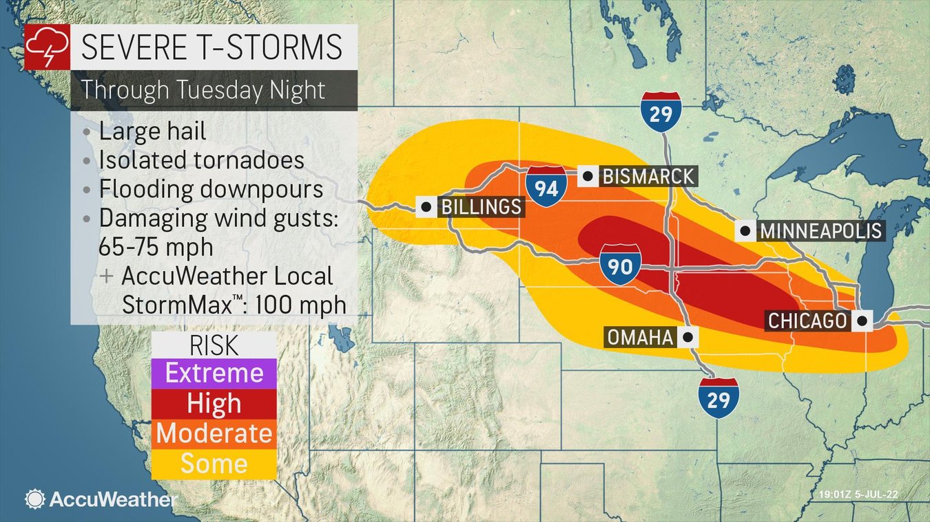
The severe weather threat will shift farther south for Wednesday afternoon and night, affecting Des Moines, Louisville, and Charlotte. One of the unique aspects of this system is that the threat of wind damage is much more widespread than what typically occurs with most severe thunderstorms. Damage is expected in a large area, and power outages could impact hard-hit communities for days. People in the path of this storm are encouraged to fully charge their cellphones and other important electronics before the storm’s arrival. The storms are forecast to produce damaging wind speeds of up to 75 mph with an AccuWeather Local StormMax of 85 mph. If wind damage occurs from the same complex of storms over hundreds of miles, it may be considered a derecho. A derecho is a storm complex that causes damage continuously or intermittently for 400 miles or more along a 60-mile-wide or more swath, according to the Storm Prediction Center (SPC). Recent derechos have caused extreme damage in the U.S.
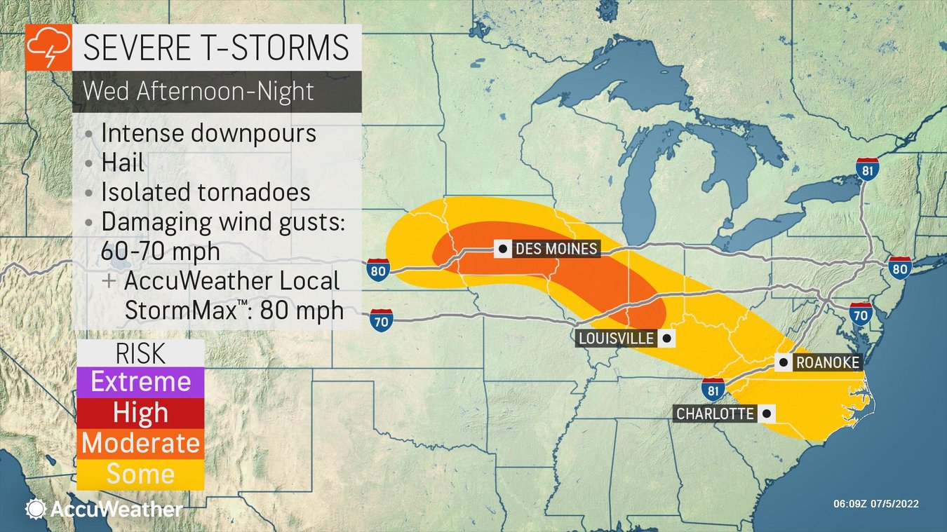
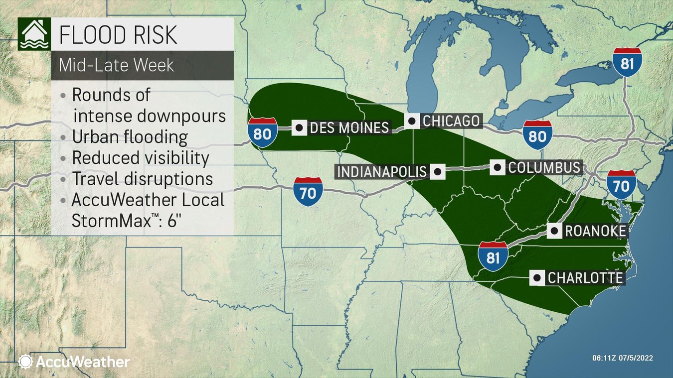
This system is also capable of producing dangerous flash flooding. The repeated rounds of thunderstorms could produce heavy rainfall, up to 3 inches in a very short period of time, elevating the risk for rapidly rising water, including flooding of creeks and streams as well as roadways.
Businesses in the area need to keep a close eye on this system and should:
- Prepare for business interruption due to extended power outages
- Expect ground logistics disruption due to road closures, downed trees, and power outages
- Take precautions to prevent loss of inventory due to flooding if your warehouse is in a low-lying area
- Ensure all employees and visitors on-site have a way to be notified of severe weather
Partner with us to weather the storm
AccuWeather meteorologists have a proven track record of Superior AccuracyTM and timely warnings that businesses rely on. Protect your people, property, and production with SkyGuard®. On average, SkyGuard clients receive weather warnings 2x faster than public alerts. In addition to this, AccuWeather’s innovative new Premium+ feature, which you can activate in the AccuWeather app, can track severe weather even while you sleep. Setup nighttime alerts on your cellphone and let us monitor the storms, keeping you informed and ahead of any threats even while you rest.