SEVERE WEATHER SET TO STRIKE THE SOUTH
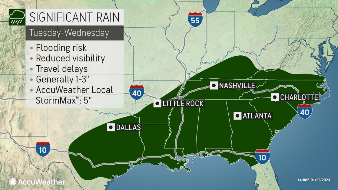
The same storm that will produce accumulating snow from the Plains to the Northeast will also produce a threat for severe thunderstorms and flooding rainfall beginning on Tuesday across Texas. AccuWeather’s world-renowned meteorologists say this will shift eastward and expand northward into midweek, impacting areas from the central Gulf Coast into the southern Ohio Valley and Southeast.
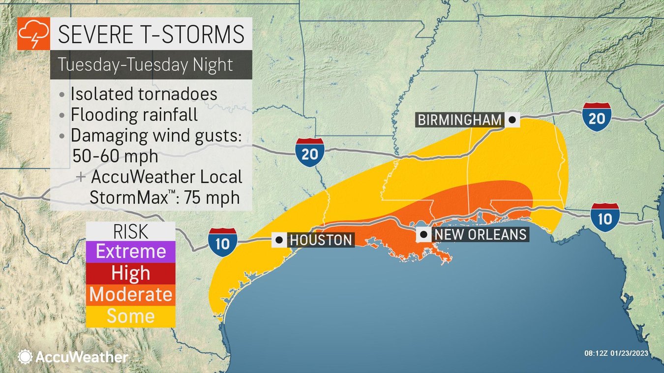
There is a threat for severe thunderstorms, with the highest risk for damaging wind gusts, hail, and tornadoes focused primarily along the central Gulf coast late Tuesday through Tuesday night. This includes a corridor from Houston to the western Florida Panhandle. This is especially dangerous in the overnight hours. The tornado threat around New Orleans will peak around midnight. There is also some risk for severe thunderstorms across the Southeast into the day on Wednesday.
By Tuesday night, severe storms can lead to hazardous travel along Interstate 10 along the central Gulf coast. Additional heavy rain across the Tennessee Valley to the southern Appalachians can lead to areas of flash flooding, which can lead to road and rail washouts by the middle of this week.
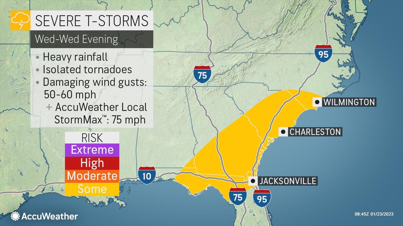
Severe weather will be possible from coastal Texas Tuesday into the interior Southeast Tuesday night and Wednesday. Isolated tornadoes, hail, and damaging wind gusts between 50-60 mph with an AccuWeather Local StormMax™ of 75 mph.
Businesses in these areas should keep an eye on the storm:
- Be prepared for business interruptions due to extended power outages
- Keep sheltering options in mind; tornado potential should be watched closely
- Take precautions if your warehouse is in a low-lying area; loss of Inventory due to flooding is possible
- Expect travel and ground logistics disruptions from flooded roads, downed trees, and power outages due to road closures.
>> FOLLOW US on LinkedIn for essential weather updates that could impact your business.
Be proactive with AccuWeather's SkyGuard® Warnings, which will deliver site-specific alerts and offer warnings well before severe weather hits, giving you much-needed time to be prepared.
Benefits of SkyGuard® Warnings:
- Proactive, site-specific alerts offer warnings well before severe weather impacts occur
- Live one-on-one or group consultation is provided by our weather experts anytime, day or night
- Alerts delivered in a format that aligns with your organizational emergency management plan
- All-clear notifications are sent when a threat is over, minimizing weather-related downtime
- All alerts are delivered via push notification from the SkyGuard mobile app, available on Android and iOS
Want to learn more about how we can help you? Demo SkyGuard® today and protect your business, employees, and assets.