Winter storm stretches across the country
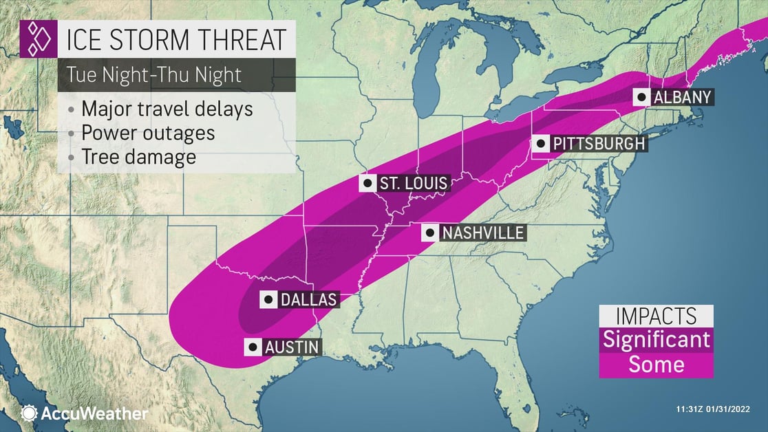
Snow will stretch from the Rockies to the Northeast, while ice will develop from the southern Plains through the Ohio Valley and into the interior Northeast. The storm will intensify into Wednesday, leading to heavy rain in the Tennessee Valley to lower Mississippi River Valleys. As the storm moves northeastward on Thursday, the rain will continue creating a threat for flash flooding. Meanwhile, Arctic air will produce some of the coldest air of the season for places like North Dakota and northern Minnesota by Thursday morning making for dangerous conditions outdoors. Temperatures will drop 20 to 30 degrees Fahrenheit over 24 hours from the Upper Midwest to the Central Plains Wednesday and to the Great Lakes and the south-central U.S. into Thursday. Some places could see a dramatic change of as much as 50 degrees.
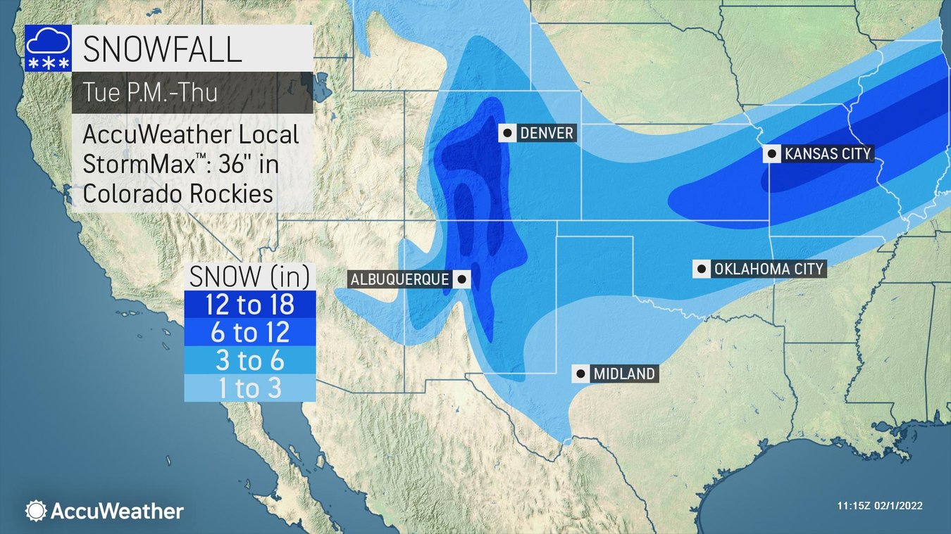
Snow will pick up across the central Rockies on Tuesday and can expand eastward Tuesday night across Kansas, to northern Missouri, Illinois, into the central Great Lakes. The Rockies could see an AccuWeather Local StormMax™ of 36 inches through Thursday.
Icing will be a problem along the Middle Mississippi Valley. An extended icing zone will develop from central Texas extending through the Ohio Valley, impacting major cities like Dallas, Little Rock, and Indianapolis. On Thursday, the snow and ice line will push south and east, hitting cities like Austin, Memphis, Pittsburgh, and Albany, New York. Heavy precipitation is also possible within this zone Thursday, which could lead to a devastating ice storm for some. Wintry precipitation will start on Thursday night in the Northeast, bringing snow to the Appalachians and northern Northeast and ice to New England.
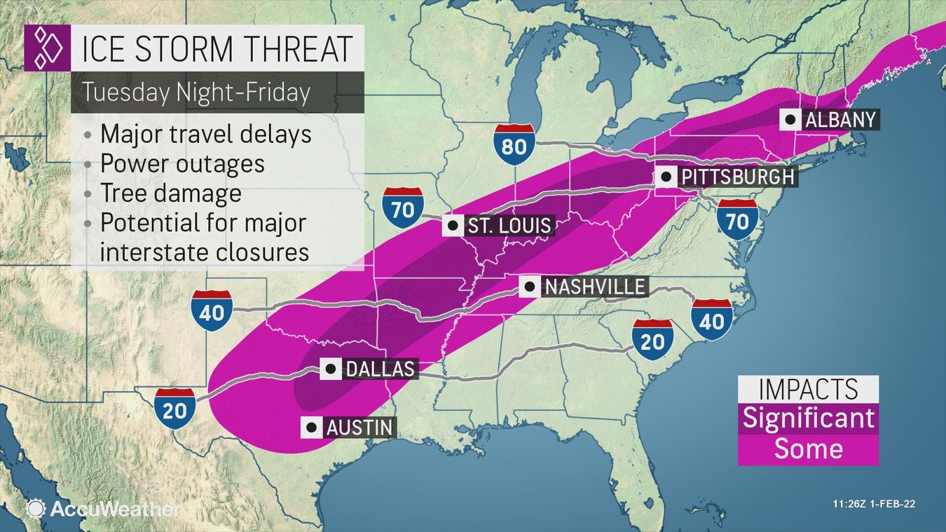
Any areas with significant snow or icing from this storm can experience downed trees and power lines resulting in major power outages. Ice can also lead to significant travel delays on interstates and major logistical disruptions for businesses.
Businesses in the area need to keep a close eye on this system and should:
- Expect business interruption due to power outages
- Anticipate disruptions to ground logistics due to road closures and snow-covered roads
- Prioritize cold weather concerns for outdoor workers
- Ensure all employees and visitors on-site have a way to be notified of severe weather
When winter weather strikes, partner with us to stay ahead of the storm
Trust our experts to help you make critical decisions with confidence whenever snow and ice threaten, starting with AccuWeather Snow Alerts™ delivered straight to your inbox. Take a step up with 1:1 business weather expert support with our Snow Warning Service TM. Or cover everything you need around the globe in all types of weather with SkyGuard® Severe Weather Warnings.