The end of the year is quickly approaching, but Mother Nature is set to bring one more winter storm to a large portion of the country. From severe weather to a significant amount of ice, and even potential for blizzard conditions could disrupt business operations before the door closes on 2020.
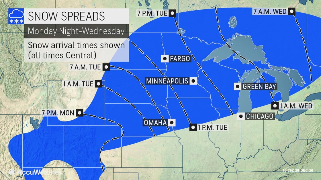
Multifaceted winter storm to impact the Midwest
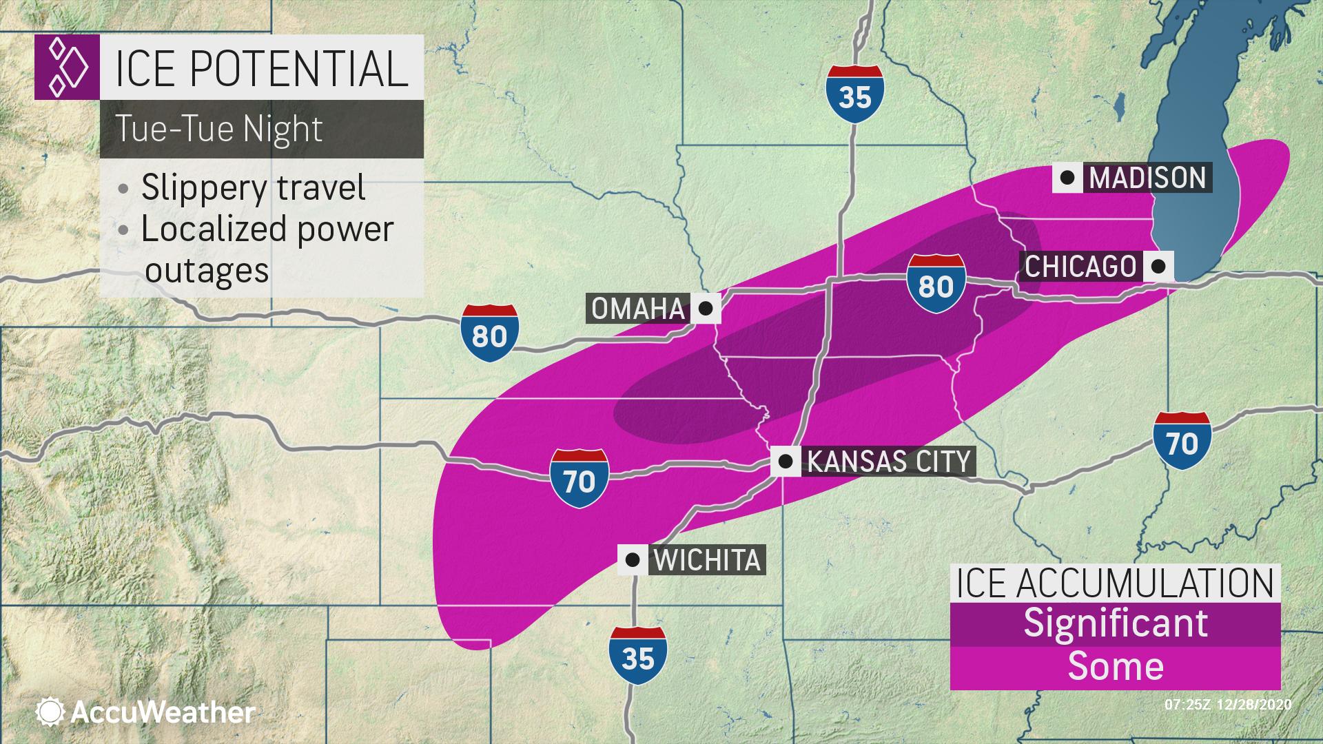
Threats: Heavy rain and snow, ice, slippery travel, localized power outages
When: December 29
Where: SD, NE, KS, MO, IA, IL, MN, WI, MI
A winter storm will bring severe thunderstorms, icing, and heavy snow to portions of the Plains through the Midwest, Eastern Canada, the Northeast, as well as the Southeast late this week.
Heavy snow of 6-12 inches will occur from the Central Plains through the Upper Peninsula of Michigan. The heaviest snowfall of 12-18 inches will fall at rates of 2"/hr across northeastern Iowa and southwestern Wisconsin.
Freezing rain will develop Tuesday morning, with the heaviest ice accretions of 0.25-0.50 inch from far northeastern Kansas and southeastern Nebraska through northwestern Missouri and southern Iowa.
- Expect ground logistics disruption due to road closures and downed trees
- Ice damming leads to roof leaks, and at ground-level can force water into a building, damaging equipment or inventory
- Businesses should prepare for power outages
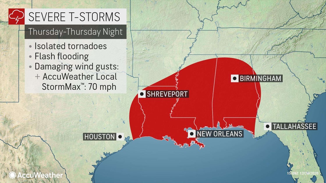
Strong storms to close out 2020 in LA, MS, AL and the FL panhandle
Threats: Isolated tornadoes, flash flooding, dangerous wind gusts
When: December 31
Where: LA, MS, AL, FL
Worrisome thunderstorm activity will develop later Thursday afternoon as a low pressure strengthens.
The most prevalent threats with these severe thunderstorms will be damaging wind gusts with an AccuWeather Local StormMax™ of 70 mph and heavy downpours. Due to an abundance of warm, moist air flowing inland from the Gulf of Mexico and feeding these storms, flash flooding is likely to occur, especially in urban areas.
- Tornado potential should be watched closely; keep sheltering options top of mind
- Business interruption due to extended power outages and structural damage can be expected
- Temporary structures designed for COVID-19 response will be especially at risk
- Loss of Inventory - If your warehouse is in a low-lying area, precautions should be taken

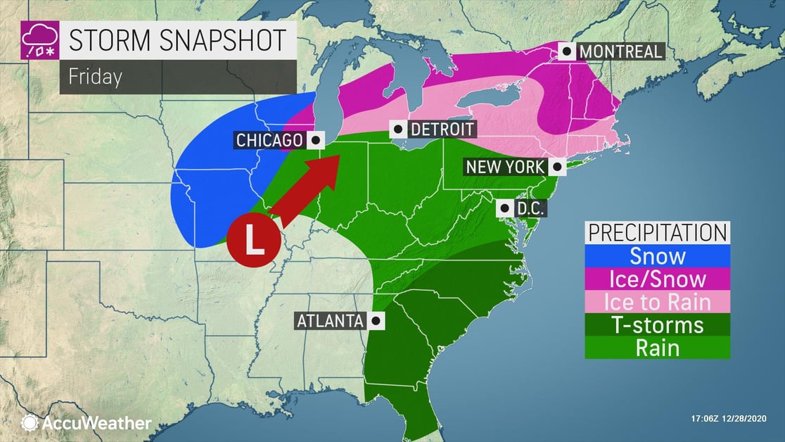
Wintry mess to ring in the New Year in the Northeast
Threats: Heavy snow, sleet, freezing rain, slippery travel, localized power outages
When: January 1
Where: NY, PA, MA, NH, VT
Freezing rain will develop Friday morning across the Northeast, with ice accumulations occurring across these regions. Snow will follow across northern portions of the Northeast into Saturday morning.
The areas most likely to have several hours or more of freezing rain and a buildup of ice will be from central Pennsylvania northeastward to interior New England.
- Expect ground logistics disruption due to road closures, downed trees, especially along portions of I-95
- Ice damming leads to roof leaks, and at ground-level can force water into a building, damaging equipment or inventory
- Businesses should prepare for power outages