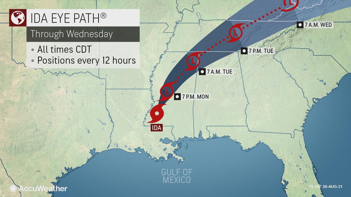
Ida still wreaking havoc
A weakening Ida is still wreaking havoc as it moves inland. Mississippi is expected to be hit the hardest today with flooding rains, up to 12 inches in some areas, and gusty winds capable of knocking down trees and power lines. Tornadoes remain a threat across the state as well as in neighboring Alabama and Louisiana. The storm, which made landfall Sunday at Port Fourchon, Louisiana, has already caused devastating storm surge, coastal flooding, and destructive winds along the coast of southern Louisiana.
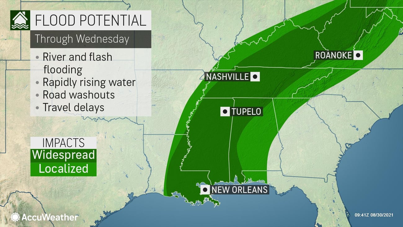
Ida still poses a significant threat to life and property even as it moves away from the coast. Flash flood watches extend from Mississippi through the mid-Atlantic. The storm will turn to the northeast Monday night into Tuesday, becoming a tropical depression, and bringing heavy rain across eastern Tennessee and Kentucky into West Virginia. The system will then move into the mid-Atlantic on Wednesday. As it tracks across the Appalachians, significant flooding may occur in areas that have recently been waterlogged by Fred and Henri. Impacts are expected as far north as southern New England before it moves back out to sea.
Partner with us when severe weather threatens.
AccuWeather meteorologists have a proven track record of Superior AccuracyTM and timely warnings that businesses rely on.