Hurricane watches issued as Ida gains strength
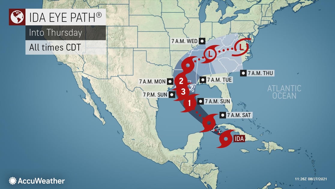
Hurricane watches are in effect from southwestern Louisiana across the border into Mississippi as Hurricane Ida continues to strengthen in the Caribbean. The storm is expected to become a major hurricane by Saturday posing a significant threat to life and property across the central Gulf Coast. Tropical storm watches are in effect from the Alabama-Mississippi state line to the border between Alabama and Florida. Storm surge watches are also in effect from Sabine Pass in southeastern Texas all the way to the Alabama-Florida border.
Since sea-surface temperatures throughout the Gulf of Mexico are very warm, further intensification into a major hurricane (maximum sustained winds of at least 111 mph) is expected before the storm comes ashore. Hurricane Ida is expected to make landfall in south-central Louisiana, bringing with it significant storm surge, coastal inundation, flooding and destructive winds.
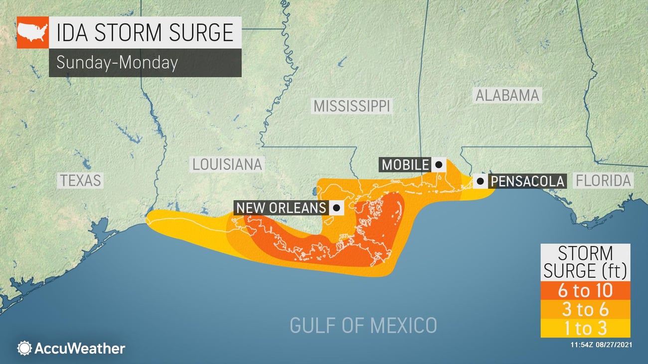
On its current forecast track, Ida could make landfall late Sunday along the central Louisiana coast as a dangerous Category 3. As much as 8-12 inches of rain is expected in southern Louisiana. Powerful peak wind gusts of 120-130 mph are expected near where the center of Ida makes landfall. Storm surge of up to 10 feet will also impact residents in its path, especially immediately north and east of the storm center.
Businesses along the western and central U.S. Gulf Coast should continue to monitor updated forecasts and information from AccuWeather.